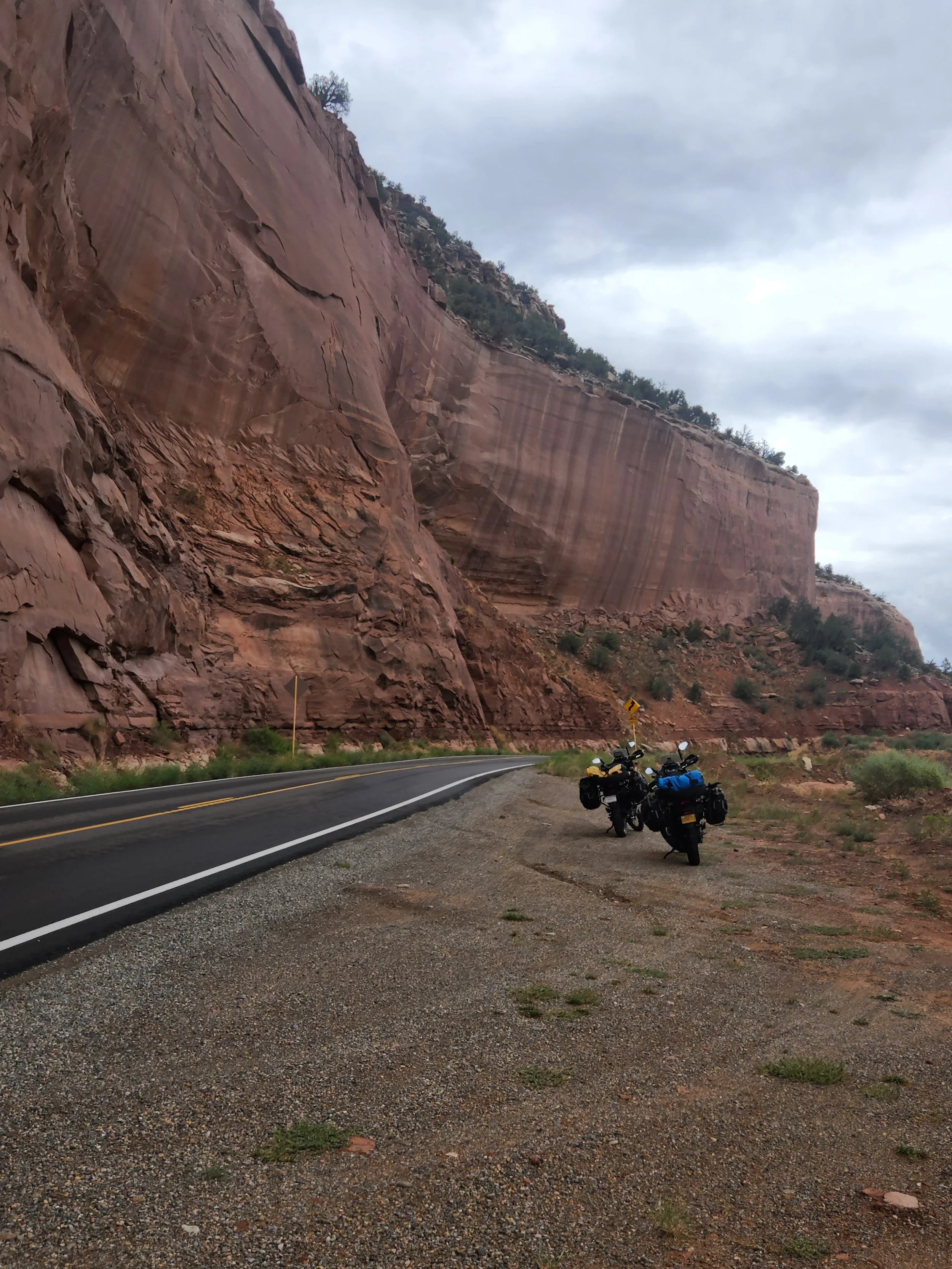
After a week or so off the bikes it’s time to hit the road again. We will be making a loop from Bullhead City into Utah and Colorado and back to Bullhead City on this leg of the trip. The first pictures are from a side trip we did in the car to Palm Springs and Joshua Tree National Park.
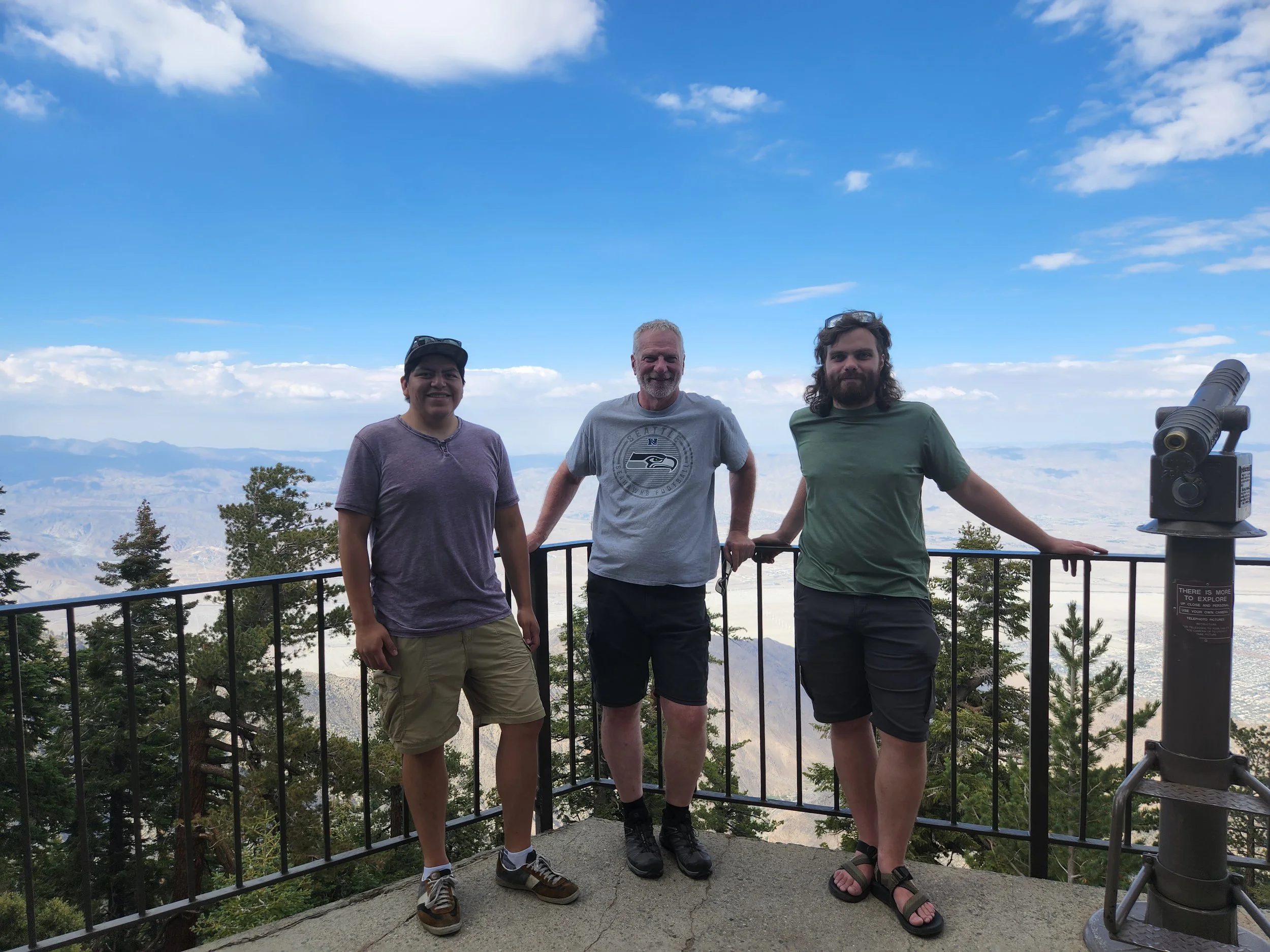
Gabe, Me and Neil at the top of the Palm Springs Tramway. It's just outside of town and at 8,500 feet in elevation a great way to beat the heat in Palm Springs!

The three of us took about an hour hike around at the top of the tram. The trail lead to a series of "notches" with views down to the valley floor.
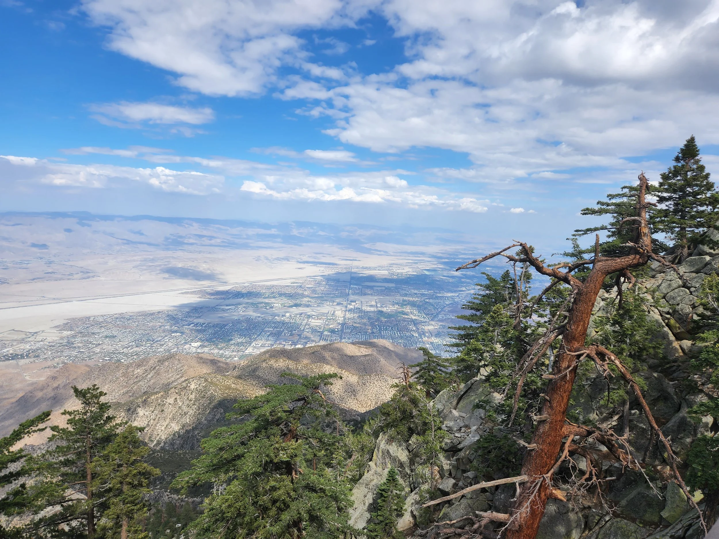
More from the top of the tram.


another of the notch views.

I couldn't get my phone and camera ready in time for a good picture, but it was cool to see this hawk on the ground. A few seconds later it flew off with a mouse in it's talons.
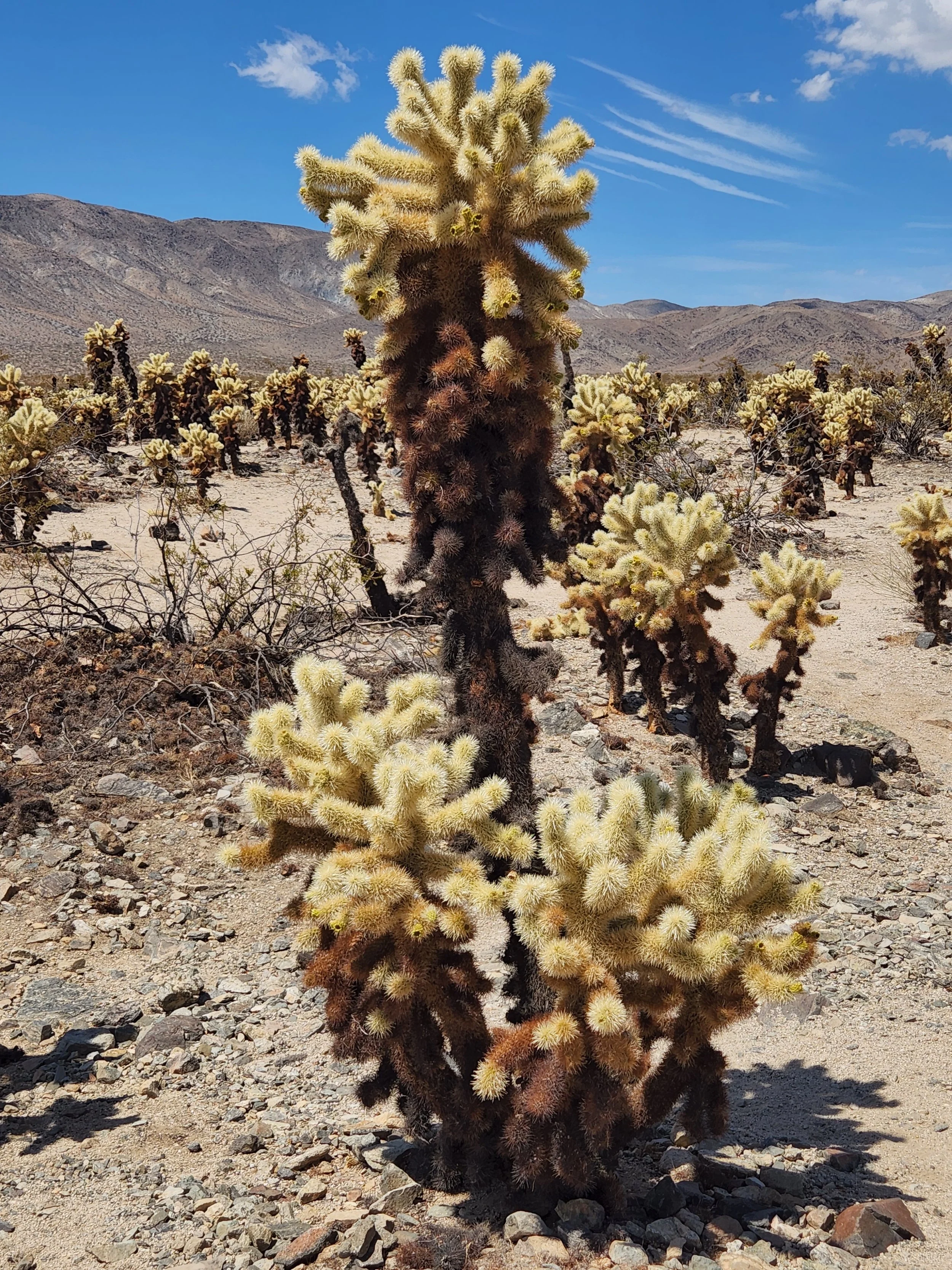
A Cholla cactus in Joshua Tree National Park
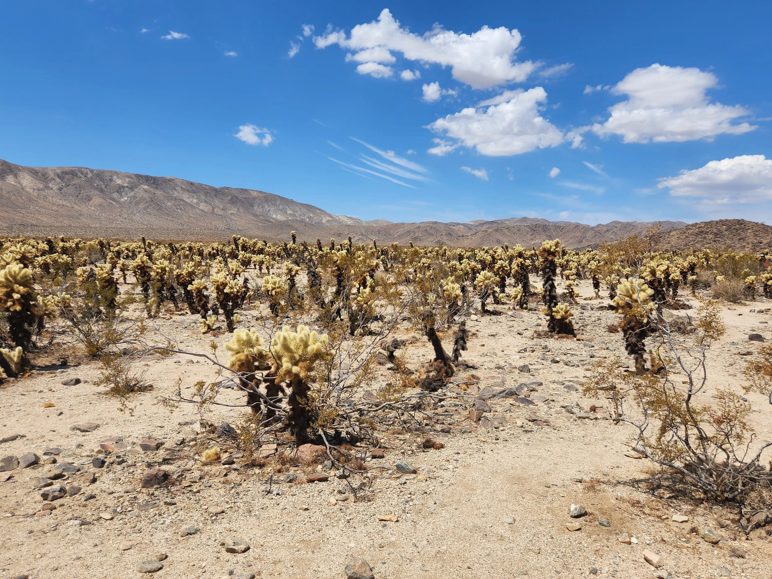
The Cholla garden.
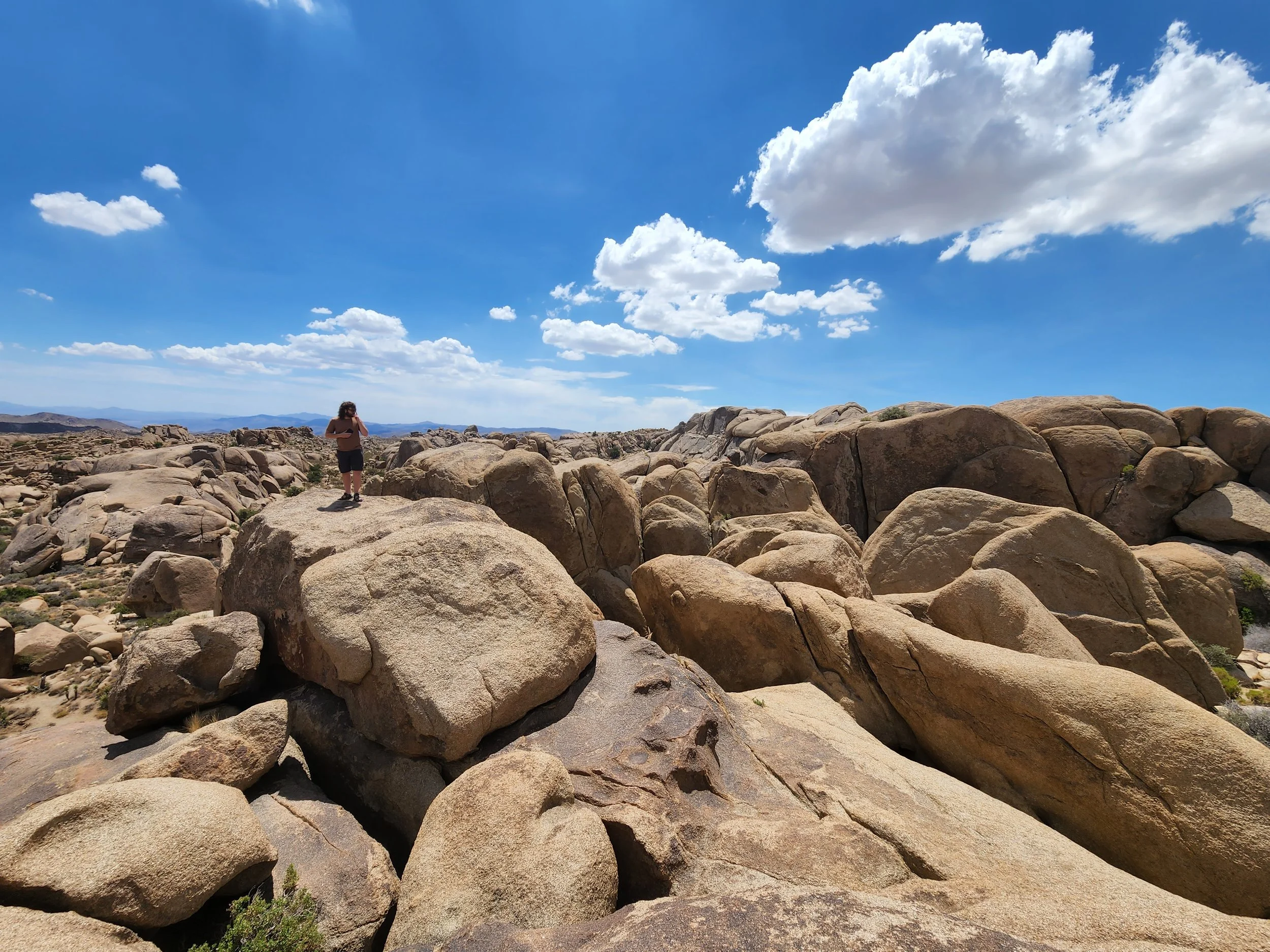
Our little bouldering expedition in Joshua Tree.

We were aiming to climb to the top of the arch above the hole in this rock formation. In the end we wound up on a different section. Going up was easy but dad's old knees weren't so good at coming down! LOL


A Joshua tree and an old man.
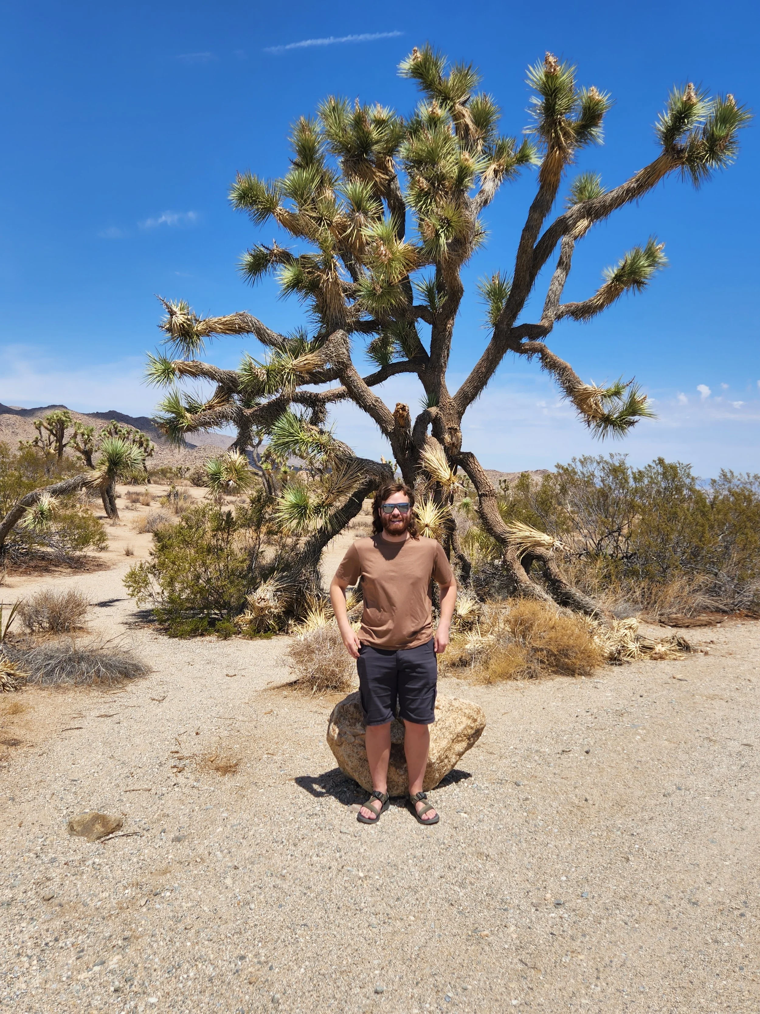
Joshua Tree and a young man.

Skull Rock - Joshua Tree National Park

Zion National Park panorama from the top of Scout Lookout. This was the top of our climb on our day in Zion.

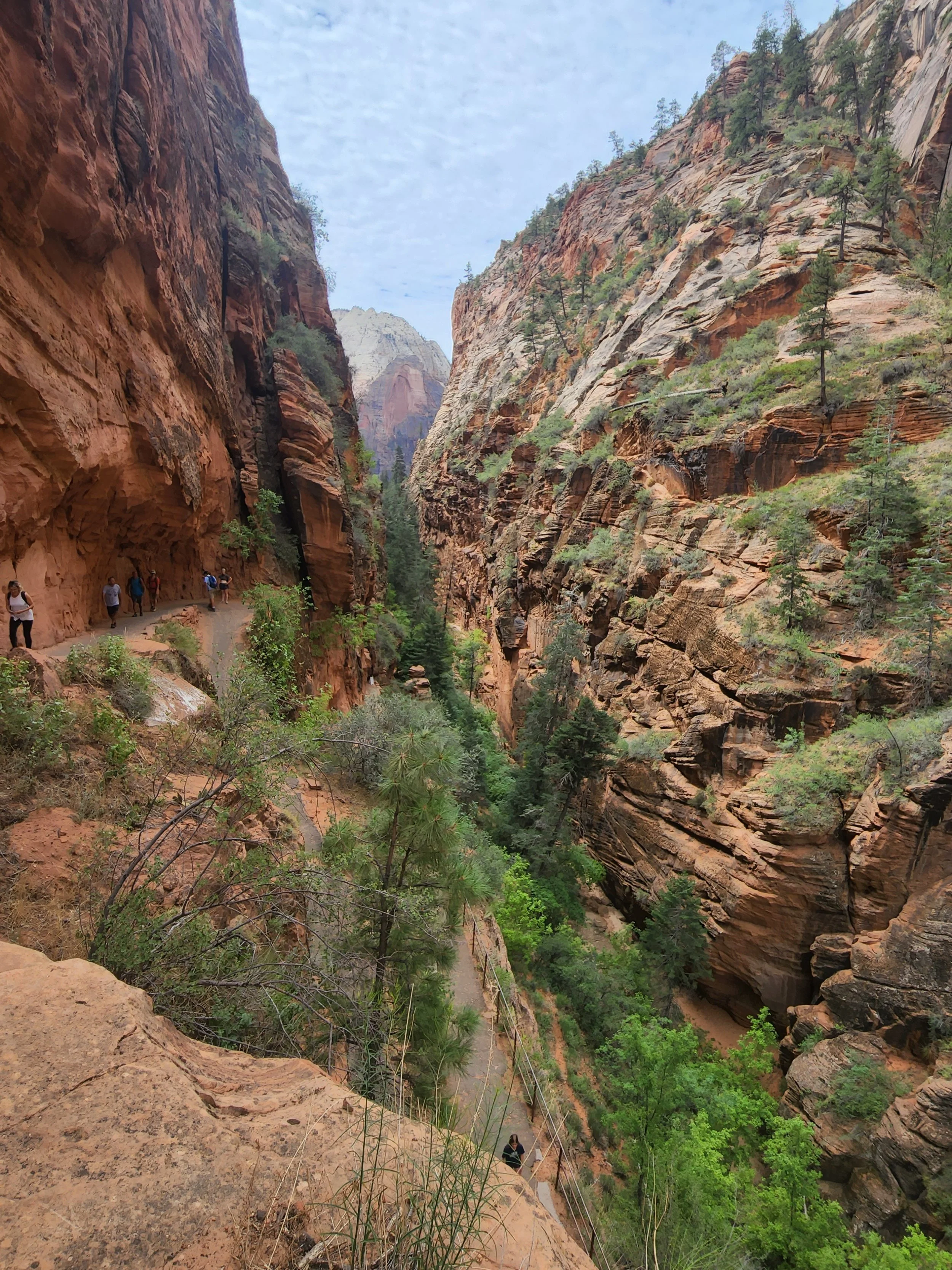
A view up one of the valleys as we climbed up to Scout Lookout in Zion NP.

The final group of switchbacks on the trail to Scout Lookout in Zion. This was a tough climb but a bit easier for me than the hike at the South Rim since that one was done in stair steps rather than the ramp style trail here.
You can see the trail up to Scout Lookout on the left side of this picture.

The base of Zion Canyon. With all the rain lately it's very green and the river it pretty high for this time of year.

It's hard to see in these pictures just how steep the trail is in some parts. In the background you can see the end of the trail as it hits the valley floor also.

More of some of the lower trail switchbacks at Scout Lookout.

Angel's Landing. If you look closely you can see the people on the ridge climbing to the lookout at the top.

Zion NP.

After we finished the Scout Lookout trail we came back to the Zion Lodge and did the Emerald Pools trail. This is the waterfall that feeds the Lower Emerald Pool with the trail we take to the Middle and Upper pools.
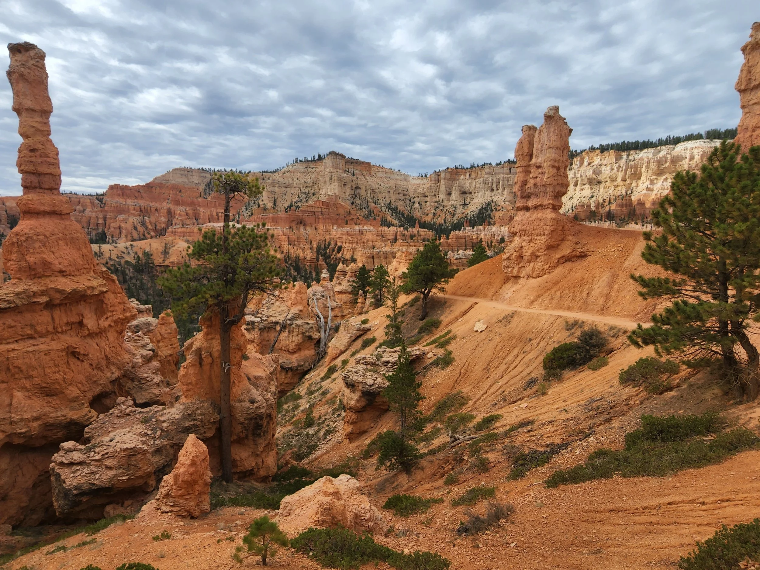
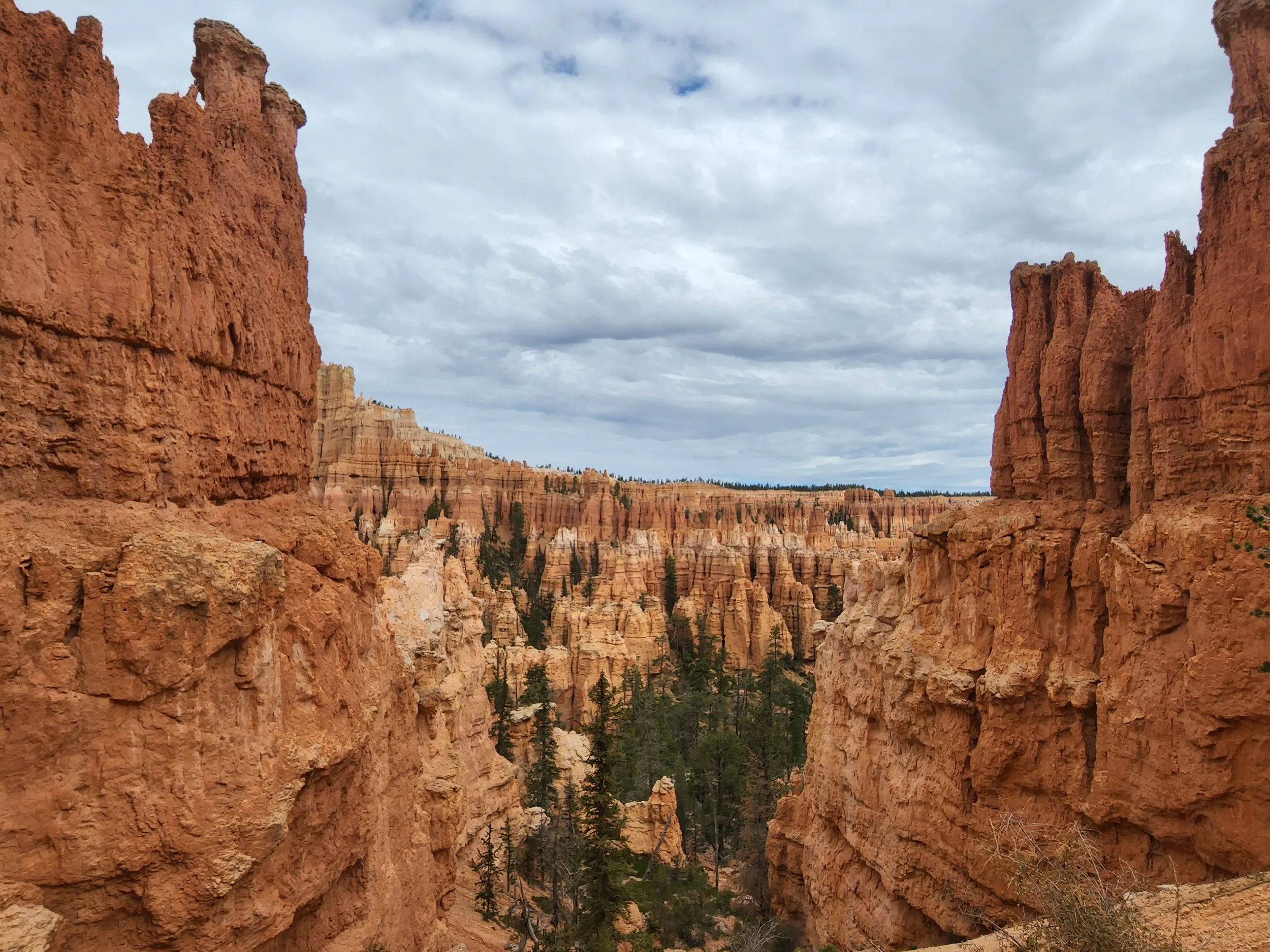
Hoodoos at Bryce Canyon National Park
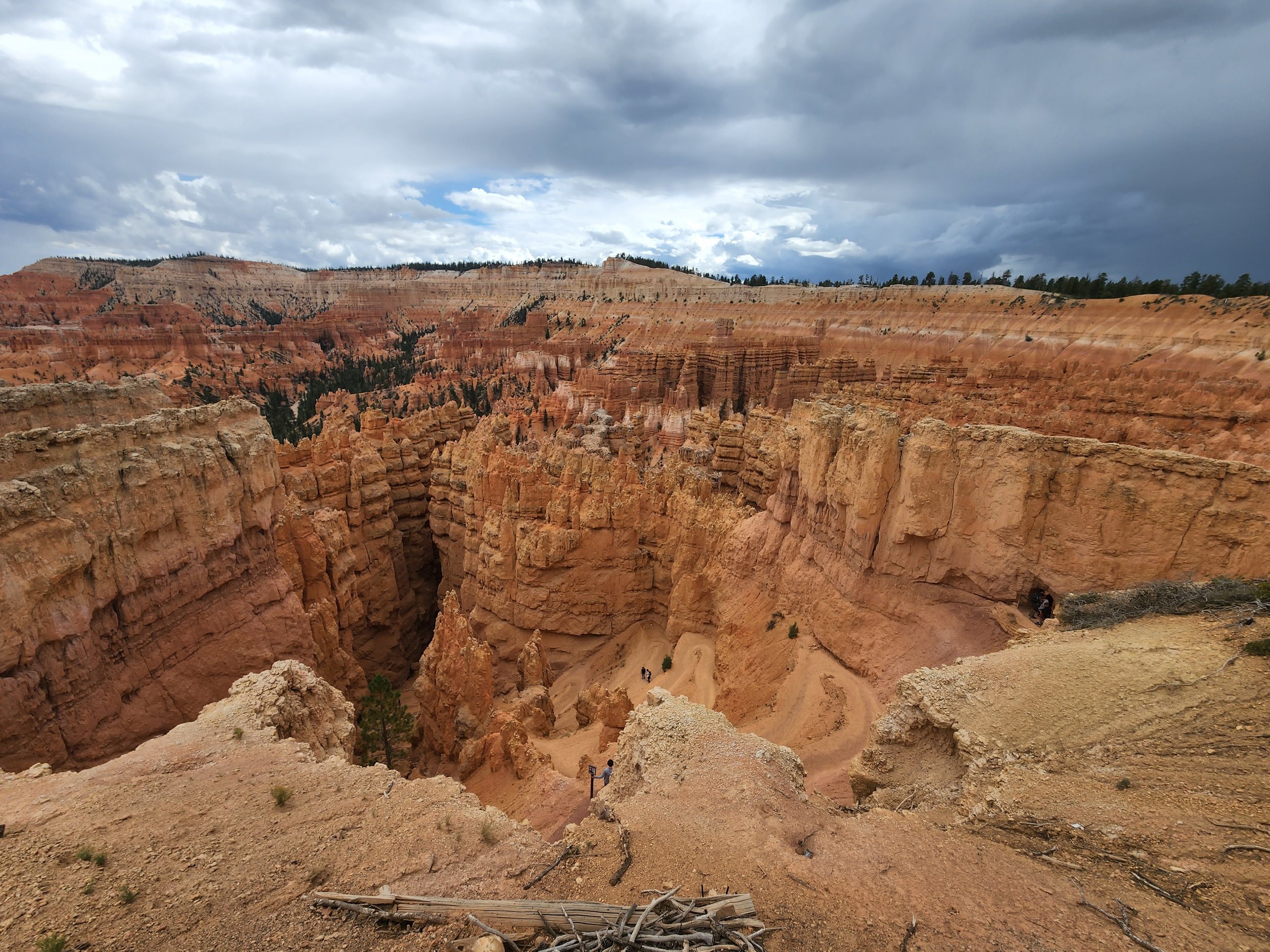
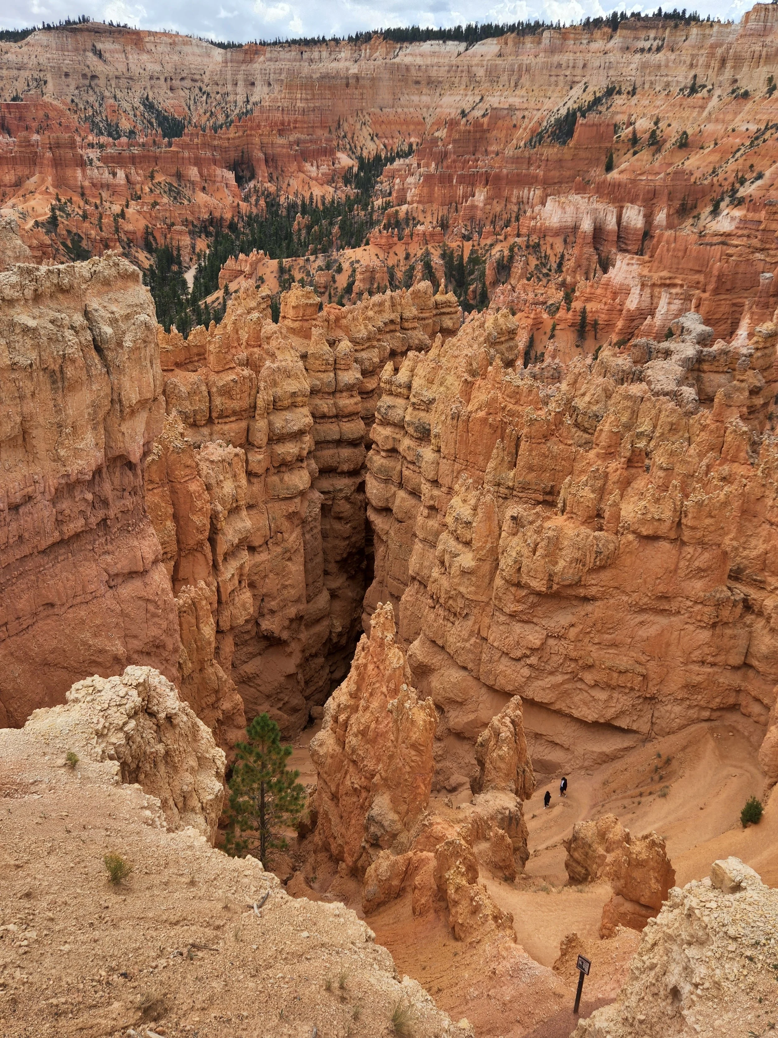
Hoodoos in The Amphitheater at Bryce. This is my third trip to Bryce and Neil's second, but this is the first time either of us have had a chance to do a hike down through the hoodoos. It's an amazing hike to do!

Taken from the rim down into the amphitheater.

One of my favorite views in Bryce Canyon.

The holes in the rock formations at Bryce are called windows. This is looking up from the bottom of the canyon during our hike.
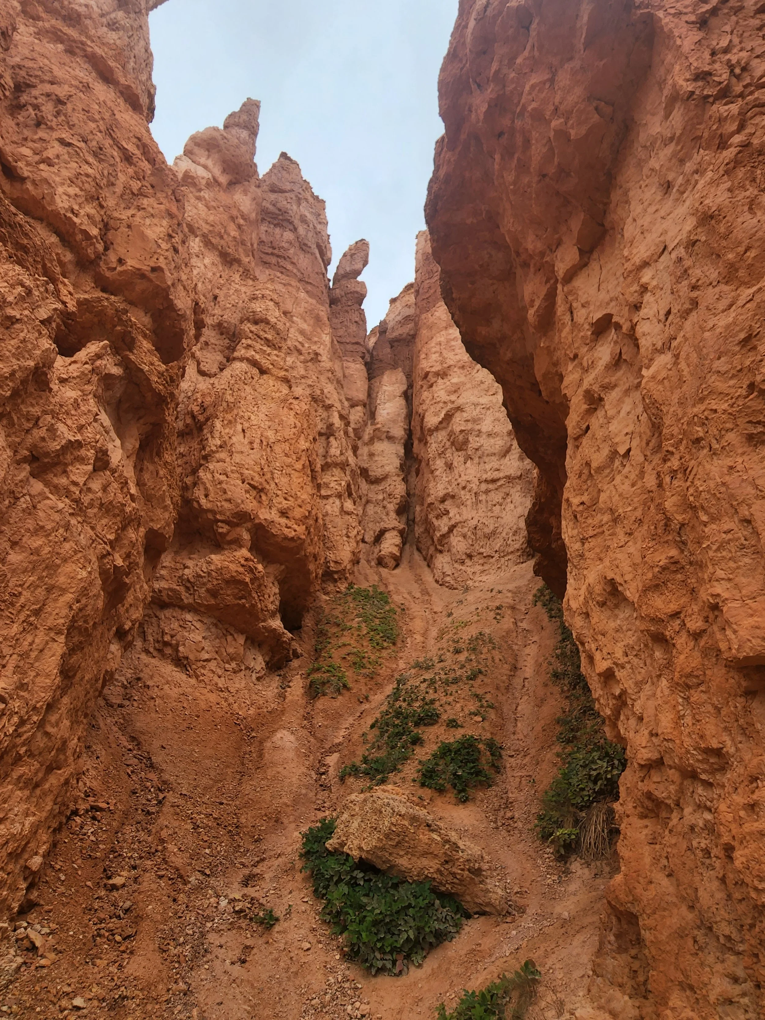
Looking up from the bottom in Bryce.
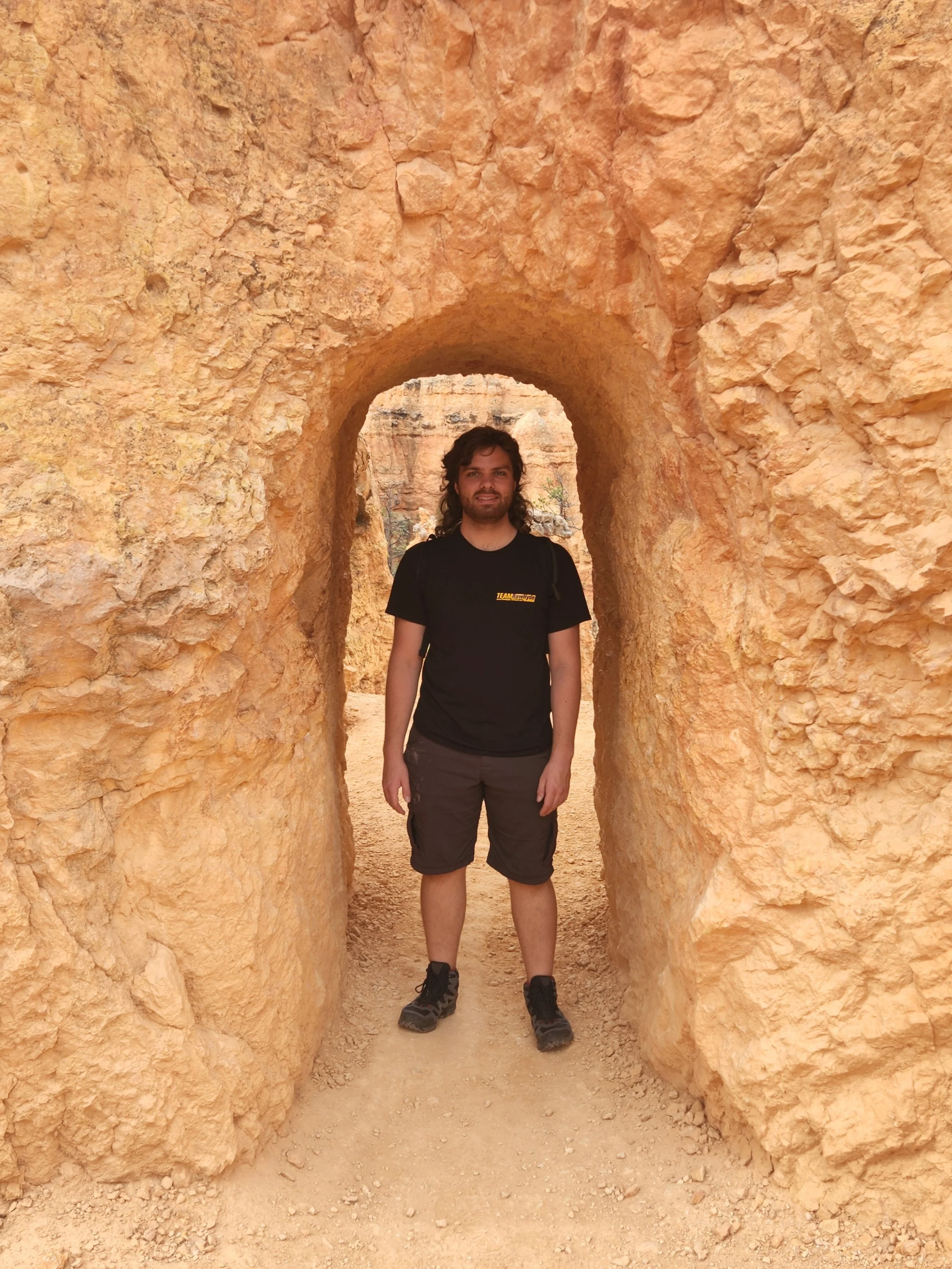
Several of the trails go through tunnels cut into the rock.

Yet more switchbacks on the hike. LOL
Our goal was that point up on the rim. The total distance on this hike was about seven miles.
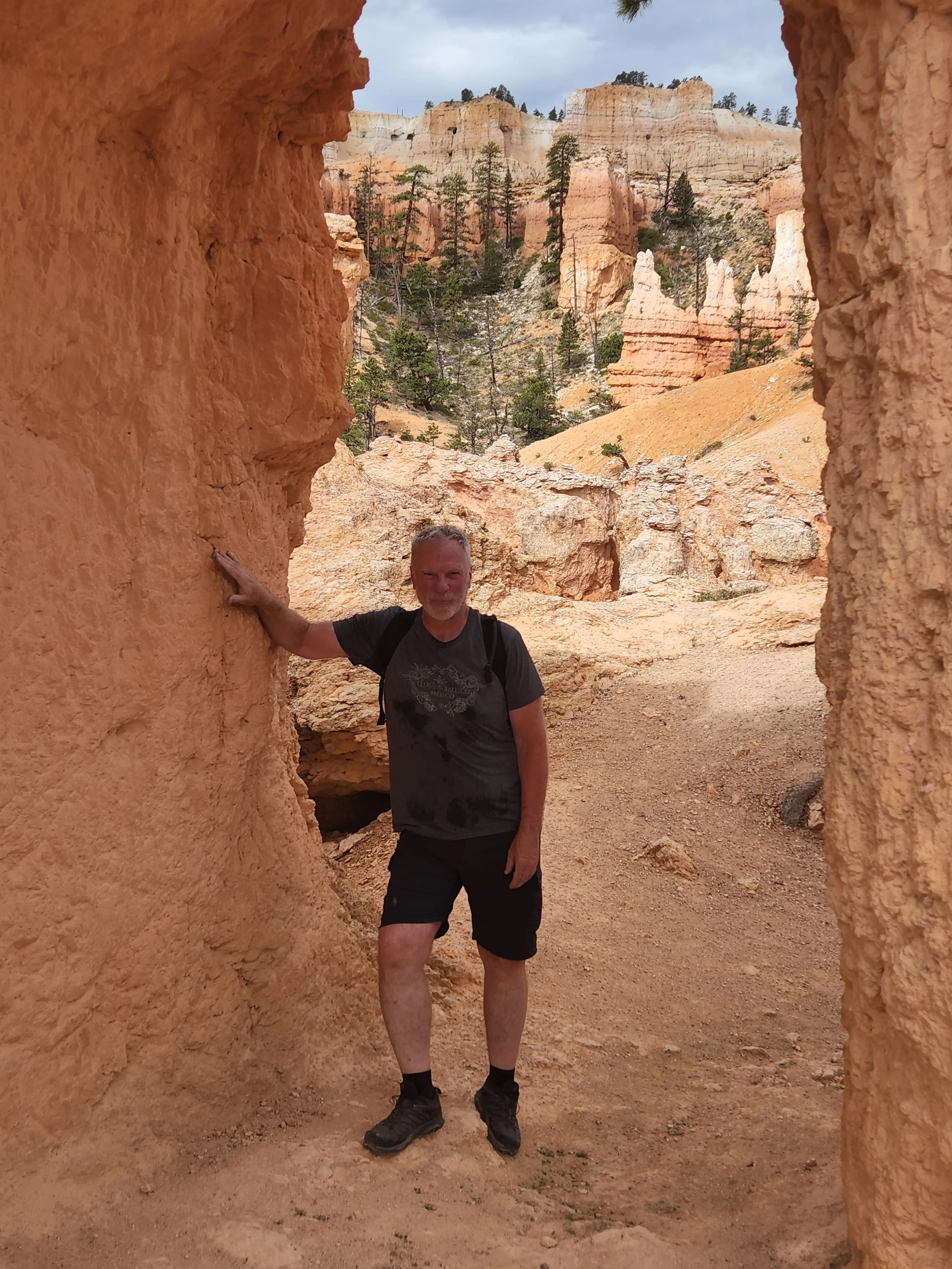
Me in another of the carved out tunnels.


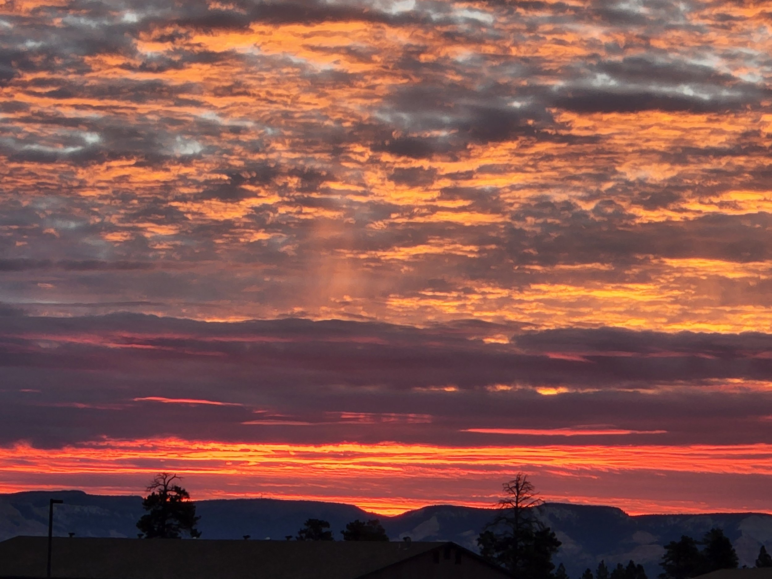
Bryce Canyon sunrise.

Another Bryce sunrise.

These pics are a bit out of order. This shot was coming into Grand Junction. We hit a pretty heavy thunder storm. We had lightening around us and the wind was so strong that we weren't safe to ride on the freeway. We had to pull off the freeway for about 20 minutes and let the worst of the storm go by before finishing the last 50 miles into Grand Junction.

We had an oil change and a new set of tires installed in Grand Junction today (8/15).. The rear tires we had replaced still had some tread left on them so we decided to keep them and will use them later. Unfortunately we forgot to bring straps along to tie them to the bikes when we went to pick them up. So it was wear a tire bandolero to get them back to the hotel.

One for each of us.

Along Route 88 near Peach Springs, AZ we found Grand Canyon Caverns. The caverns were closed but we ran into this guy on the road in.

Our official Route 66 sign picture.

This is a pretty regular occurrence for us to this point. Another thunder storm on our way to the South Rim. Luckily there was a gas station here and we pulled off and hung out at the station for an hour to let this one go by.

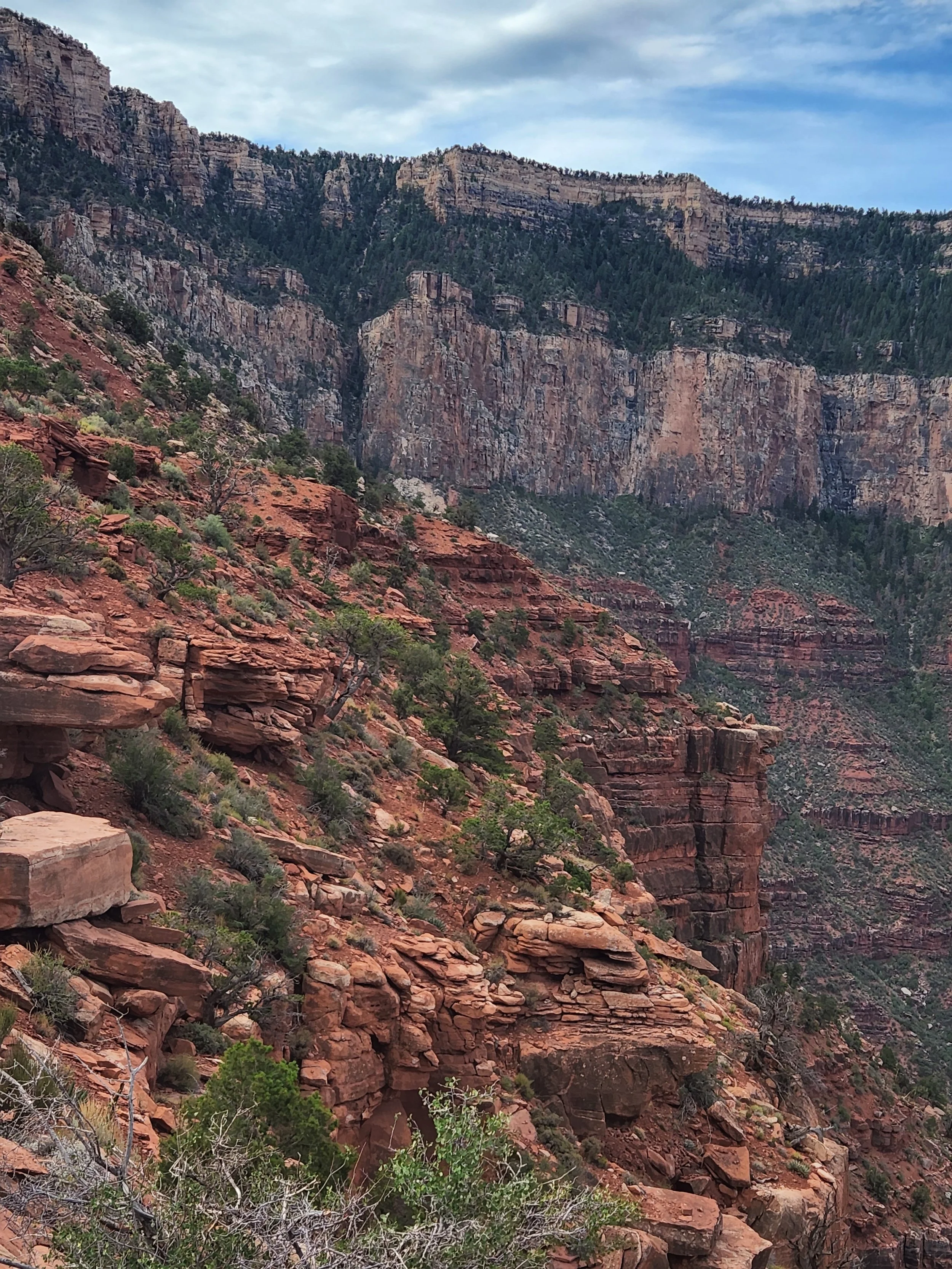
South Kaibab Trail view at the South Rim - Grand Canyon.

The switchbacks on the South Kaibab Trail

Grand Canyon

South Kaibab Trail - Grand Canyon

Con trails over the Grand Canyon

We made it to Cedar Ridge. It's as far as we went on the South Kaibab trail before turning around for the climb back out.
Back to the canyon rim.
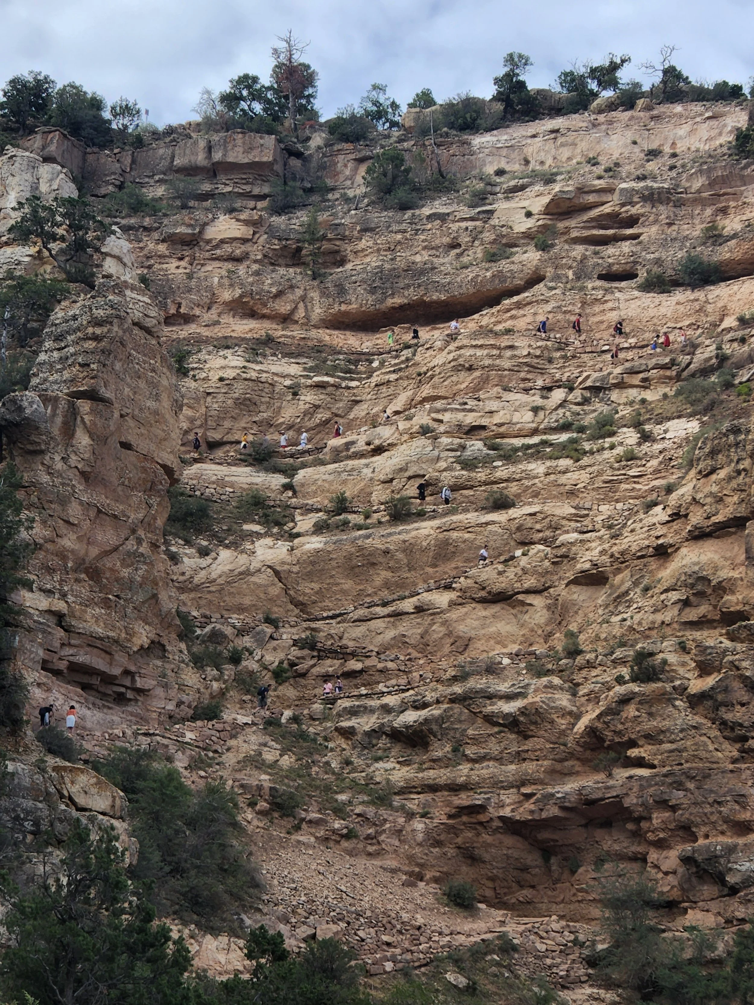
If you look closely you can see other hikers on the switchbacks back up to the canyon rim.

A beautiful view of the canyon.


The Colorado River from Navajo Bridge at Marble Canyon. This is on the road as we road from the south rim to the north rim of the Grand Canyon.
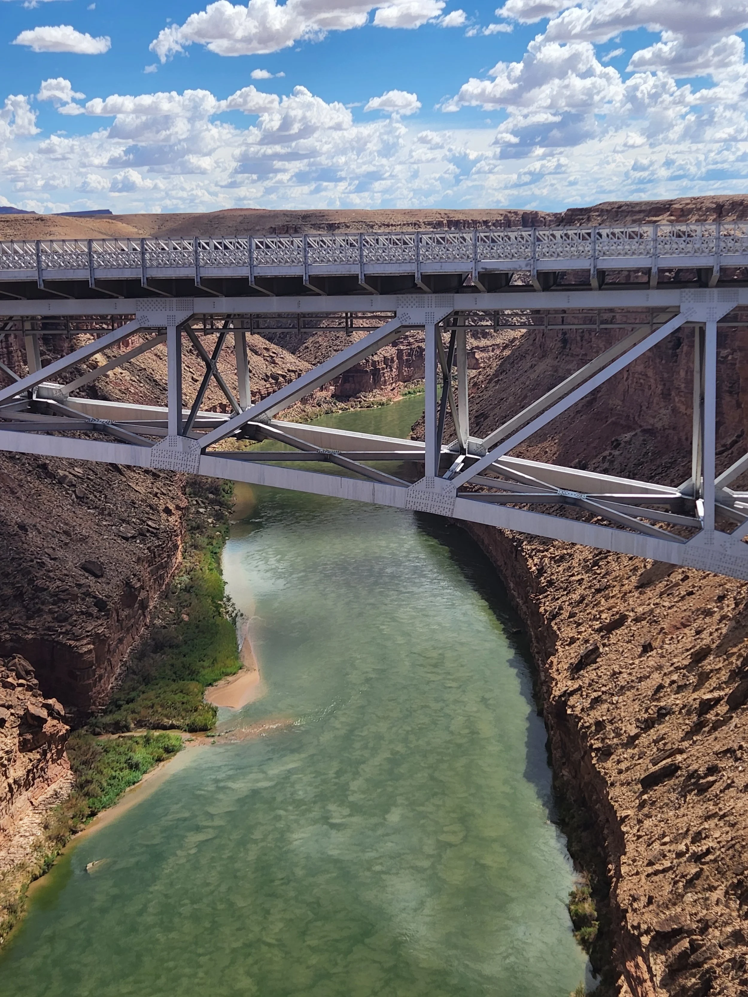
Looking the other direction from Navajo Bridge.

The moon over the north rim of the Grand Canyon

North Rim panorama.

These two again

From a short walk we did at the North Rim

The view from Bright Angel Point - Grand Canyon North Rim

Scout Lookout Switchbacks.
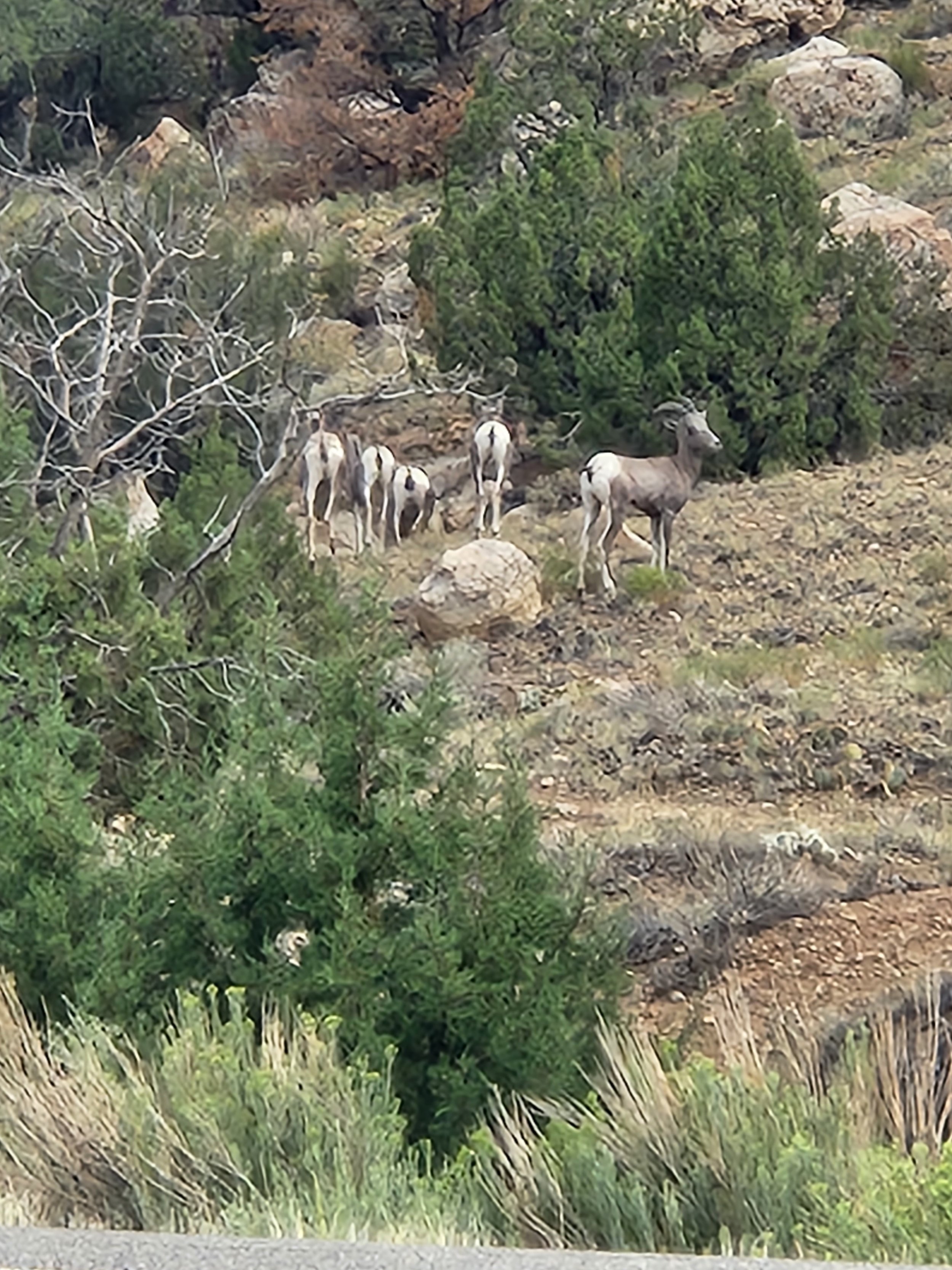
Big horn sheep along the highway on our way between Grand Junction and Gateway Colorado.
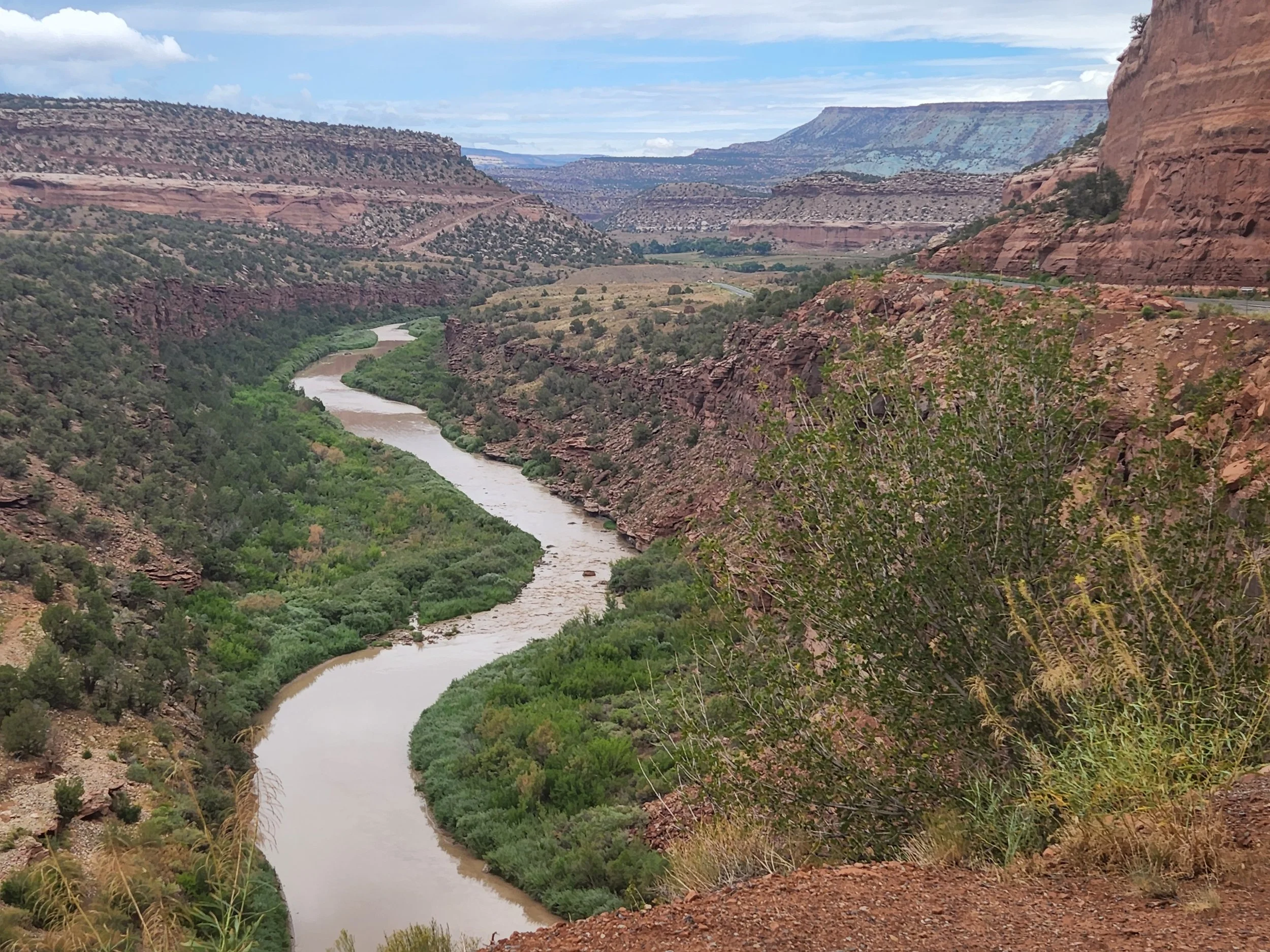
The Dolores River and canyon near Gateway, CO.
Dolores canyon was a great ride along the river.

Dolores Canyon.

View from a lookout on the road into Mesa Verde National Park.

Cliff Palace - Mesa Verde National Park

Cliff Palace - Mesa Verde National Park

Cliff Palace - Mesa Verde National Park

Cliff Palace - Mesa Verde National Park

Landscape Arch - Arches National Park

Arches National Park

Partition Arch - Arches NP.
Partition Arch - Arches NP.

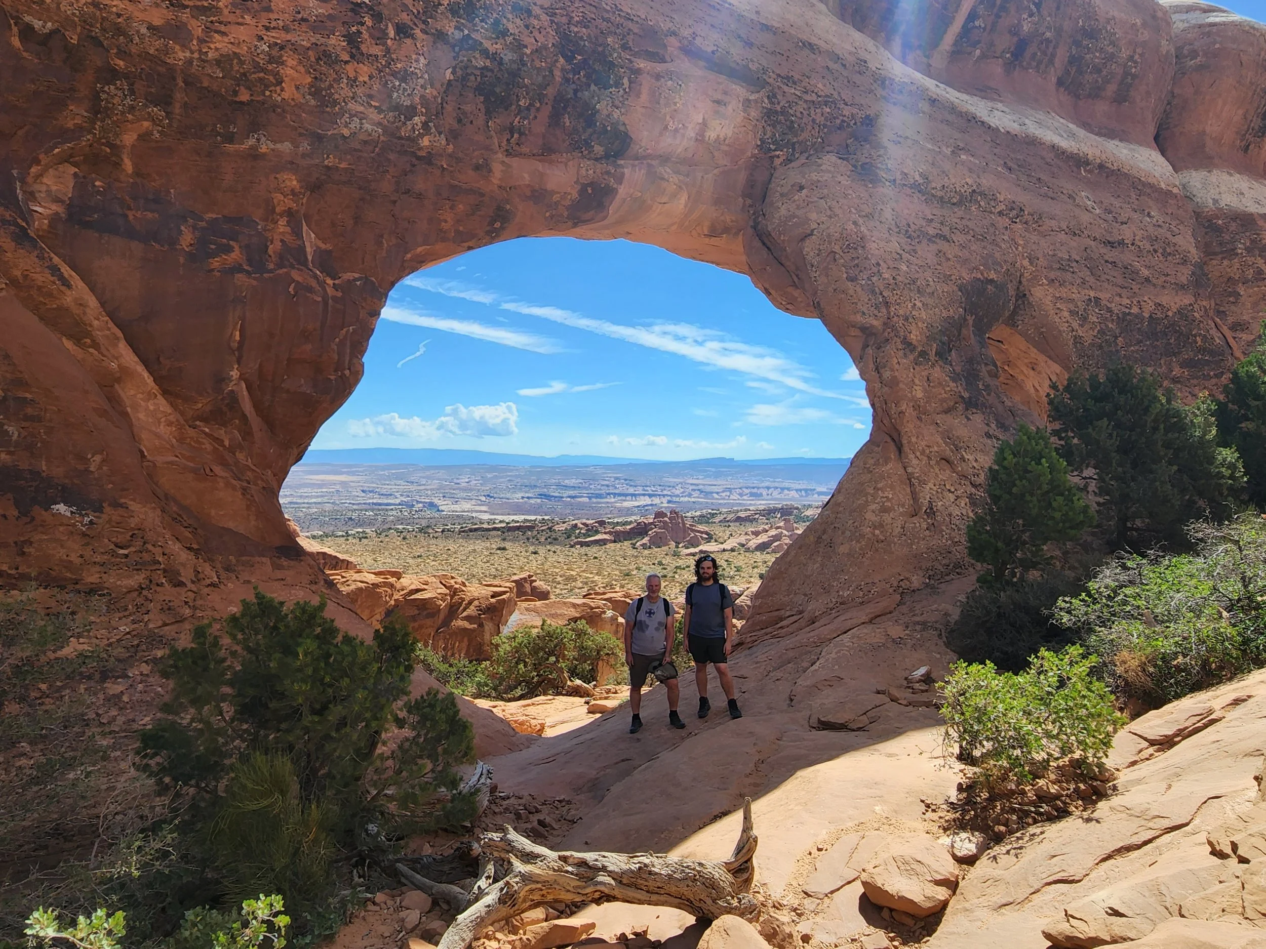
Navajo Arch - Arches NP.

Double O Arch - Arches NP.
This is the official park service trail we took on our hike in Arches. It's difficult to tell from this picture but the sides of this trail are sheer and quite high. It was the most high and narrow trail I've seen in a national park without any safety rails, ropes, etc.
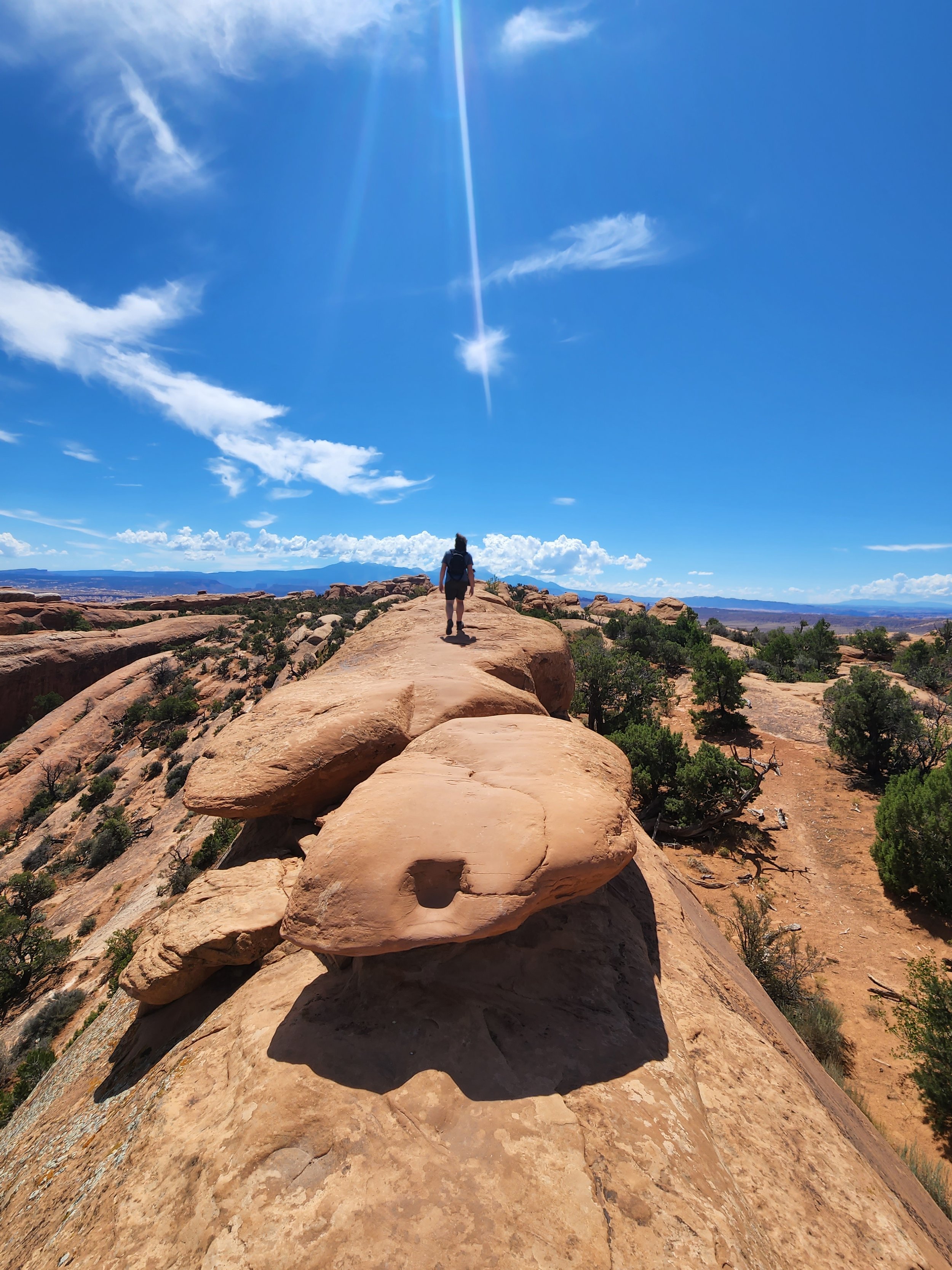
Neil on the trail to Double O Arch.
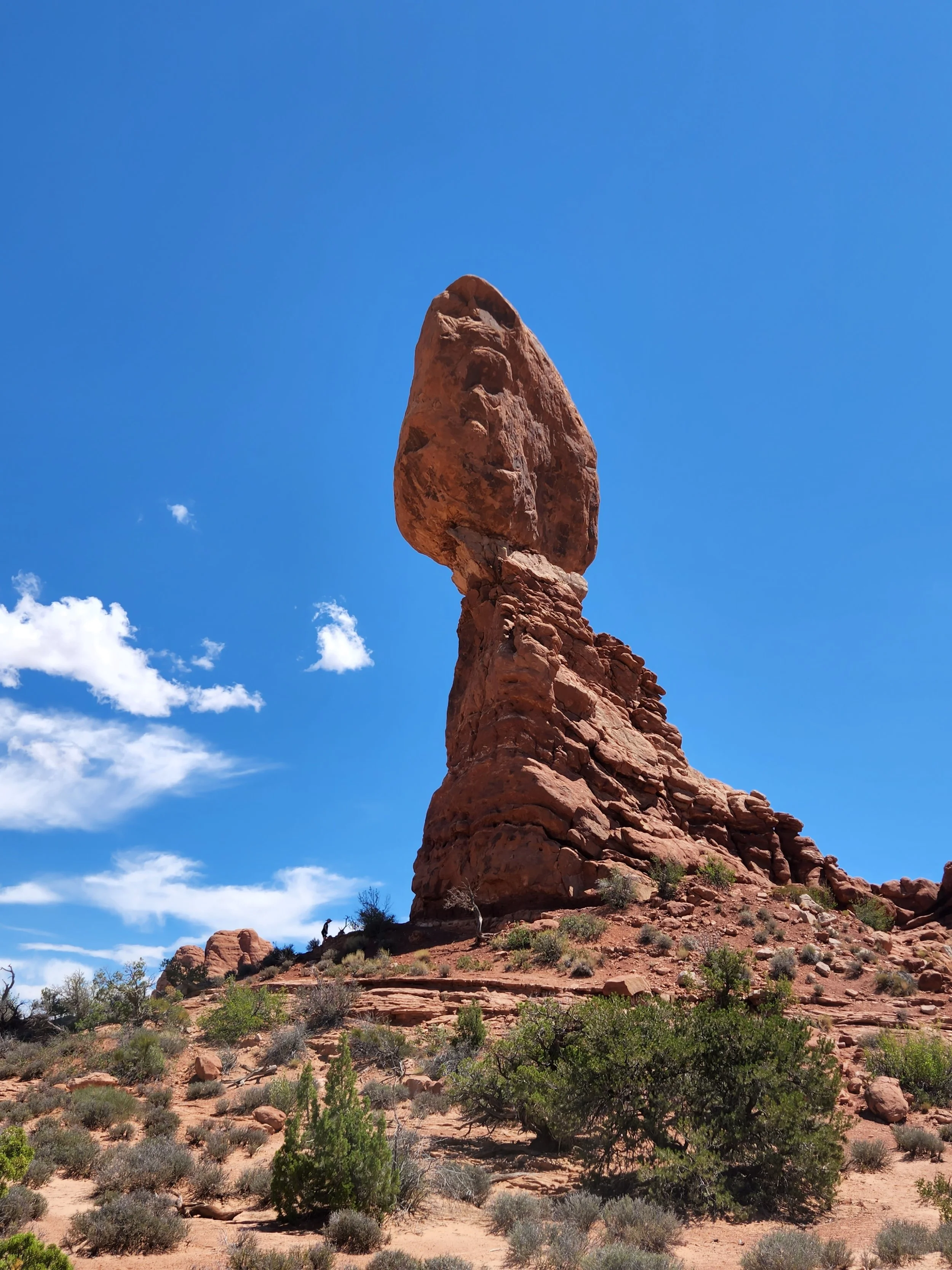
Balancing Rock - Arches NP.