

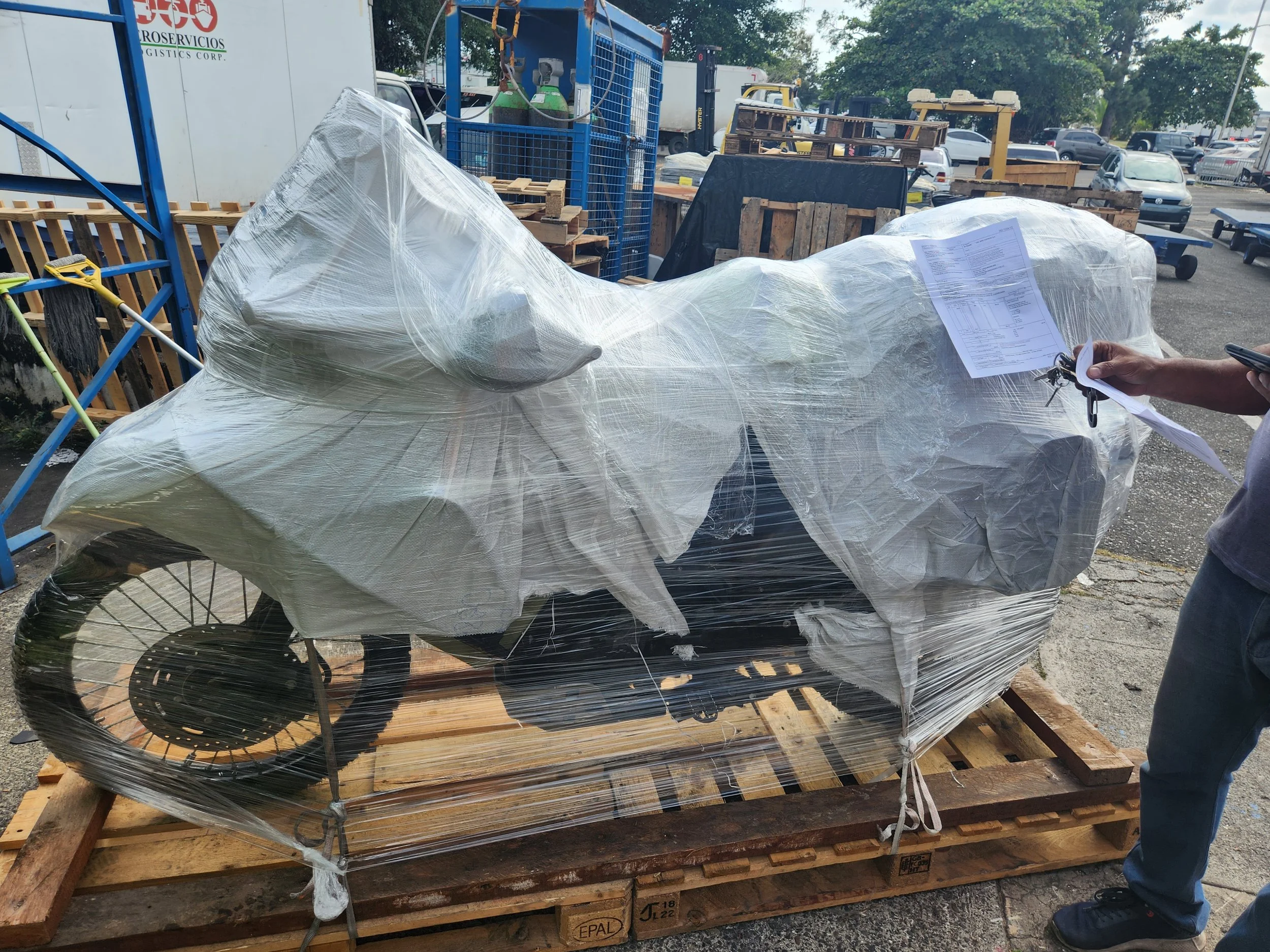
My motorcycle mummy all wrapped and ready for shipment.
And Neil's all set to go.

Linton Bay Marina, Panama. The starting point of our 5 day San Blas Island to Cartagena boat trip.

The Wild Card. Our home away from home for the trip. As we found out one that cruises at only 4-6 knots. That's about 6 miles an hour. No wonder a 250 mile trip takes 5 days.

Neil and Paxson

And the three of us.

My sleeping berth. Or as I referred to it, the sweat box. The little black thing at the end is a fan. The only thing to help cool it down when the temps were in the high 80s and humidity in the 80% range too..

Manu, our chef doing the grilling.

Our first night out was the barbeque on shore. Lots and lots of meat as well as potatoes and a salad. Good though!

Manu and Lindsey setting the table.

After dinner bon fire on the beach.
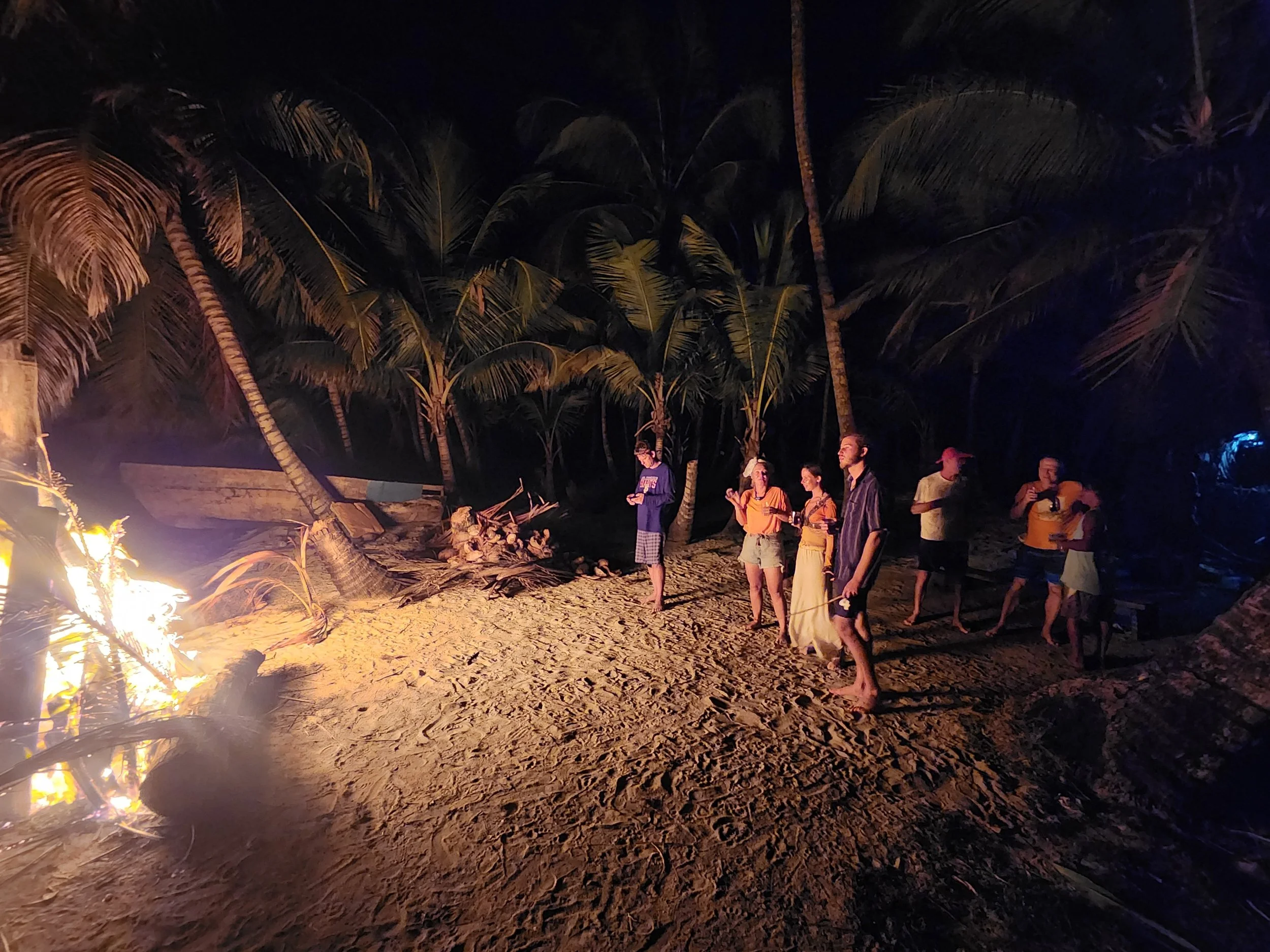
Lots of dead fallen palm fronds to make our fire out of.

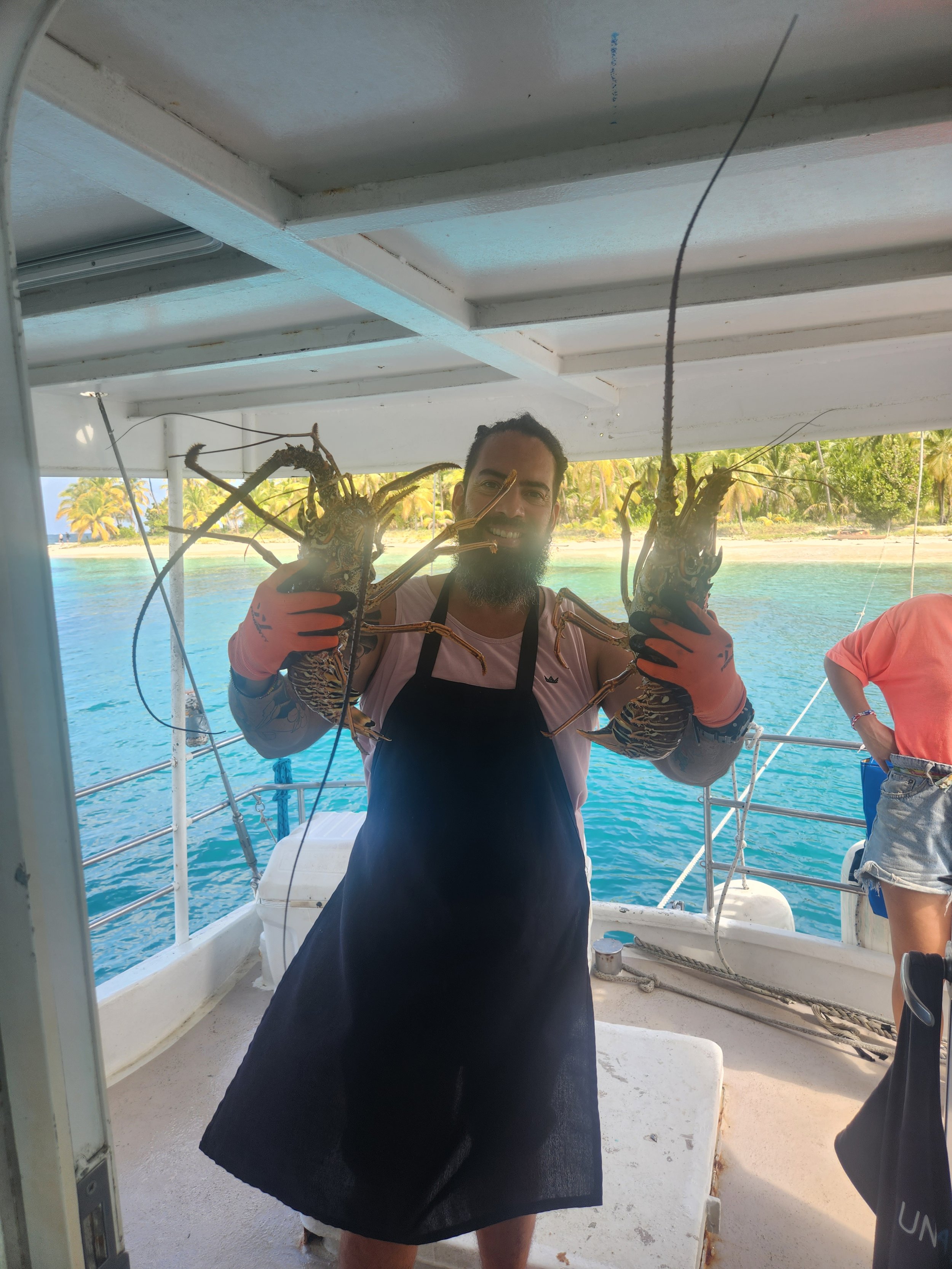
The next day's lunch that was delivered to the boat by the local Kuna fishermen.

Still alive and kicking.
Manu starting to prepare lunch.

And the finished product. It was fantastic!

Our last island. Pulling up and getting ready to drop anchor.

A still pic from the drone.

San Blas Sunset

Manu and the deck hand..

The boat had a paddle board along that also helped getting back and forth to the island if you didn't want to swim.

Sunset during the open ocean crossing.

Sunset from shore of our last island.

And we reach Colombia!
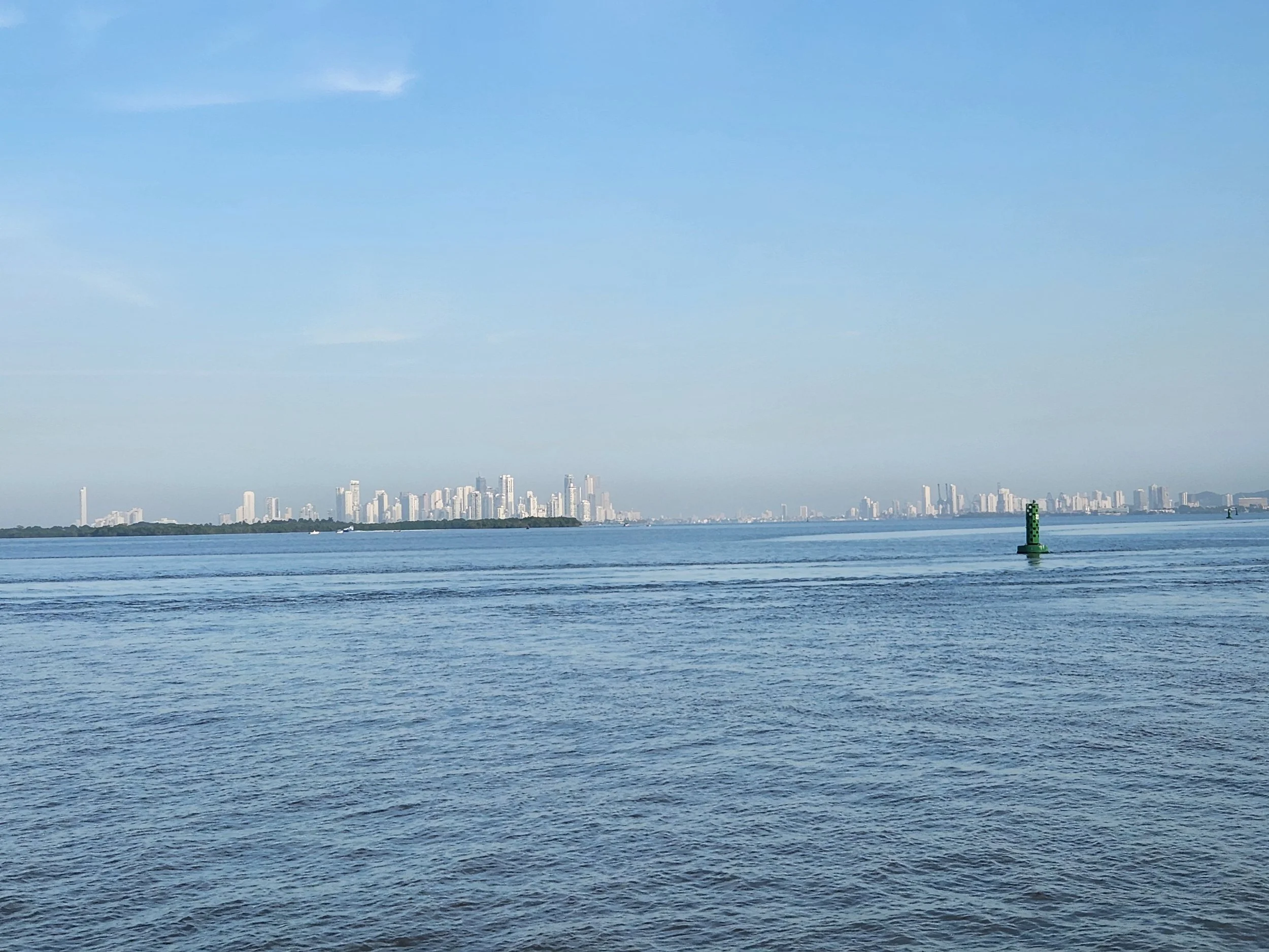
I was not expecting all the high rises in Cartagena. It's a pretty big city, but we stayed entirely in the walled old section of town for our day there.

Street food vendors everywhere near the parks and squares in the old town.

We met up with the boat group here in the Plaza de la Trinidad to get our passports back (the boat company did all our immigration paperwork) and have a final dinner and drinks together.


This part of Cartagena reminded me a lot of the French Quarter in New Orleans. From what we were told it's like this every night in that part of town.

Most of our group having a final drink together before we all head off our own directions.

One of the gates into the old walled part of the city.

These are just pictures of the old town I took while wandering around one afternoon.


The end of Cartagena.

And the bikes arrive successfully in Bogota.

Now if we can just get them on the ground without being dropped.
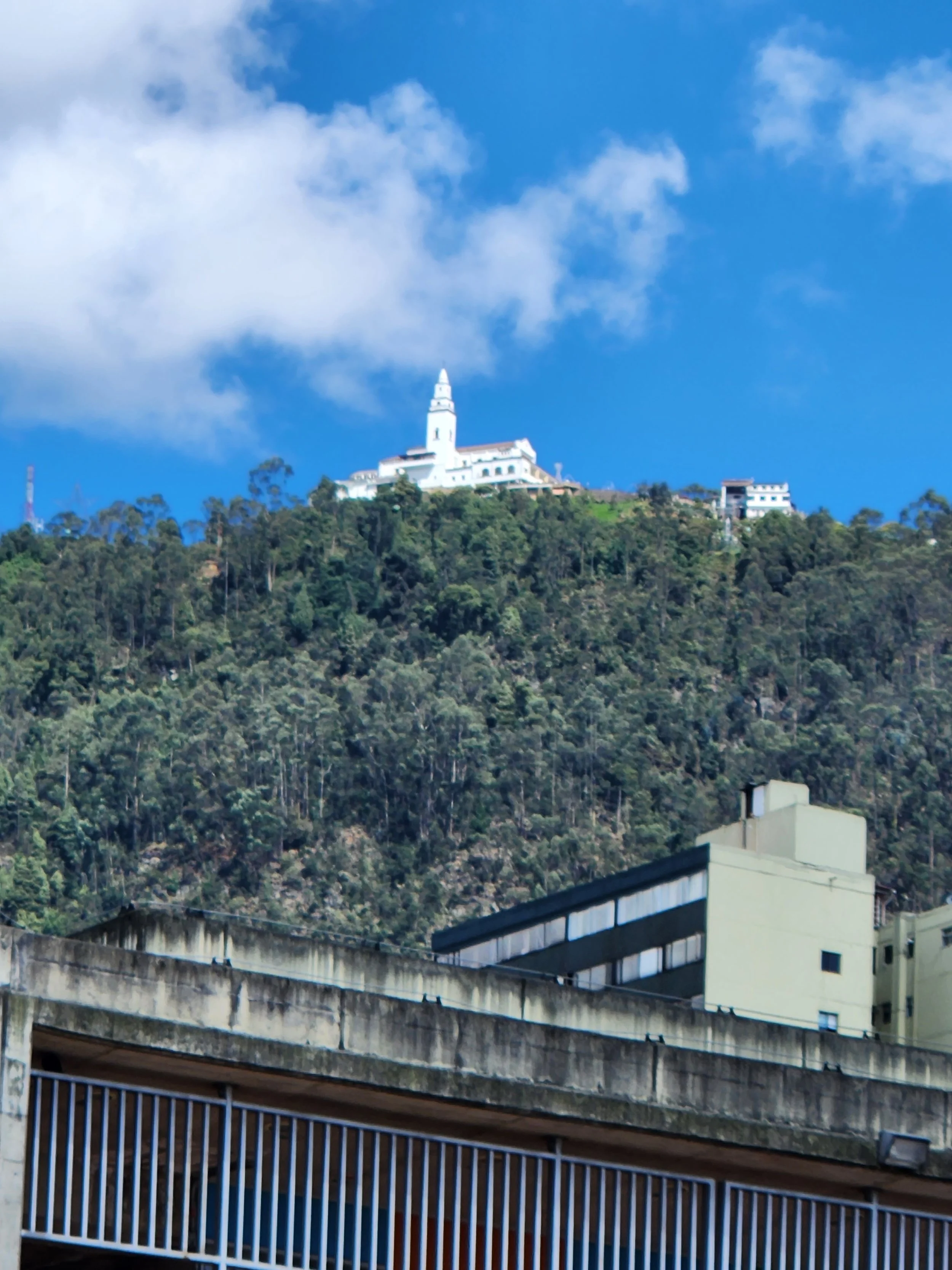
Cerro de Monserrate - Bogota, Colombia

I just found this little row of houses to be interesting in the core of Bogota.

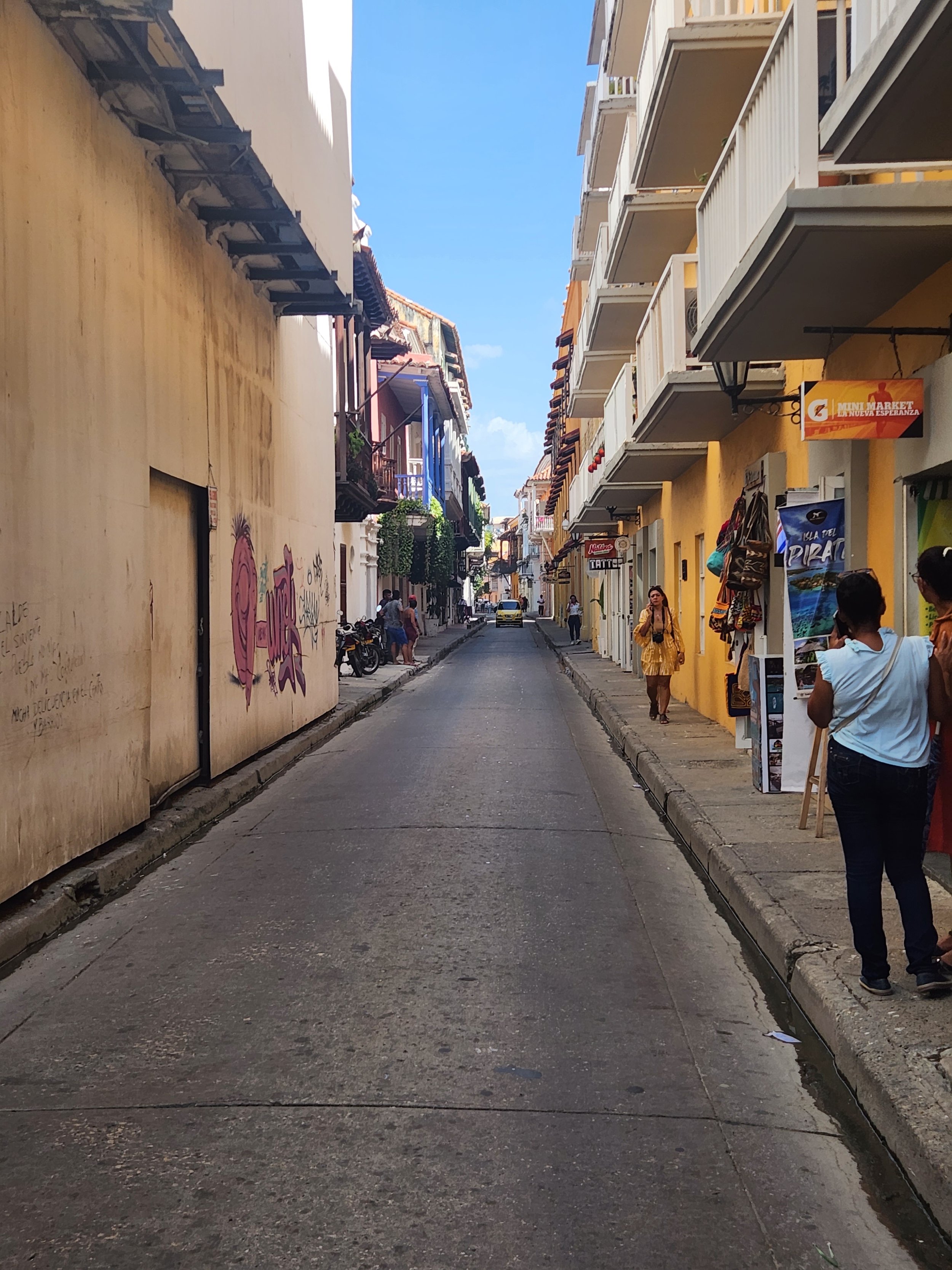
I love little alley streets like this. Full of shops and restaurants/bars.
At the bottom of the tram up to Monserrate.

It was a beautiful day for most of the day when we went up to Monserrate. As our luck would have it just as we get to the top the clouds roll in.

Bogota from Monserrate through the clouds.

Looking down the tram line to Bogota. Monserrate also has a funicular that can be used to get up to the top for those who don't like the heights of a tram.
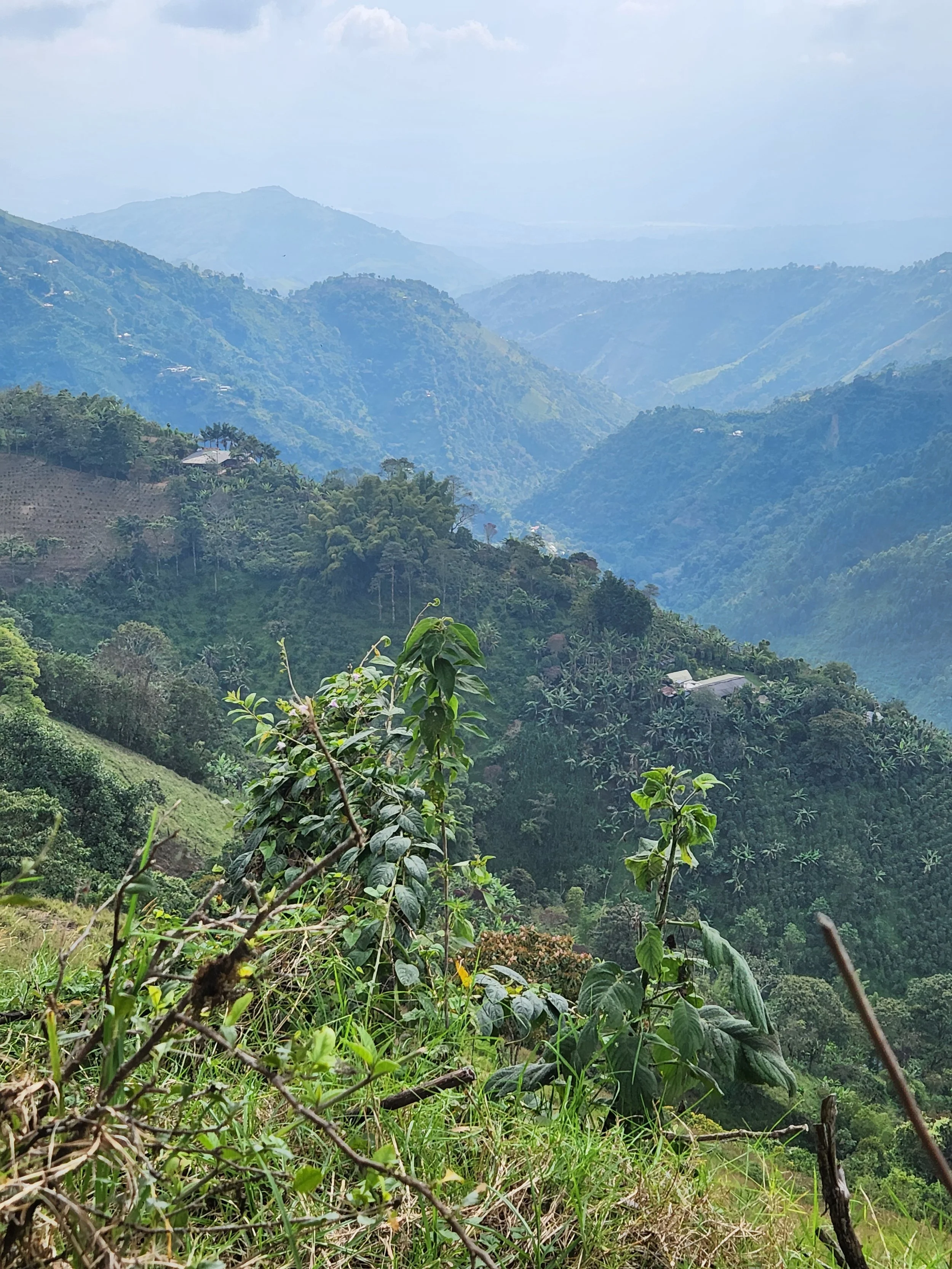
Just one of the valleys on the road between Bogota and La Dorada.

More of the countryside on the way to La Dorada.

Roadside stop for lunch on our way to Salento.

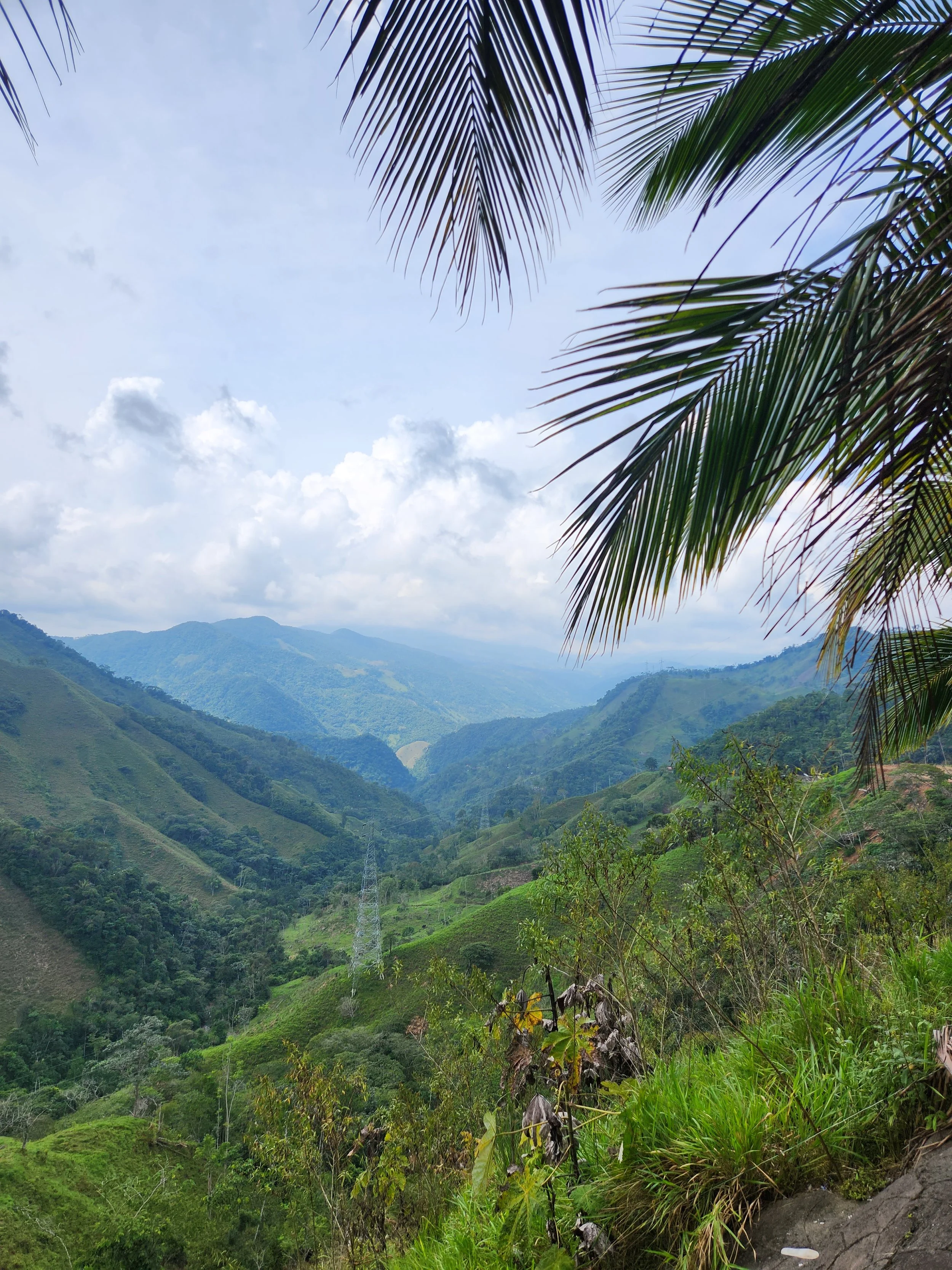
We were constantly seeing signs of landslides in the mountains. Two are visible here. I don't know if the waterfall is the cause or the result of a landslide, but it's pretty.
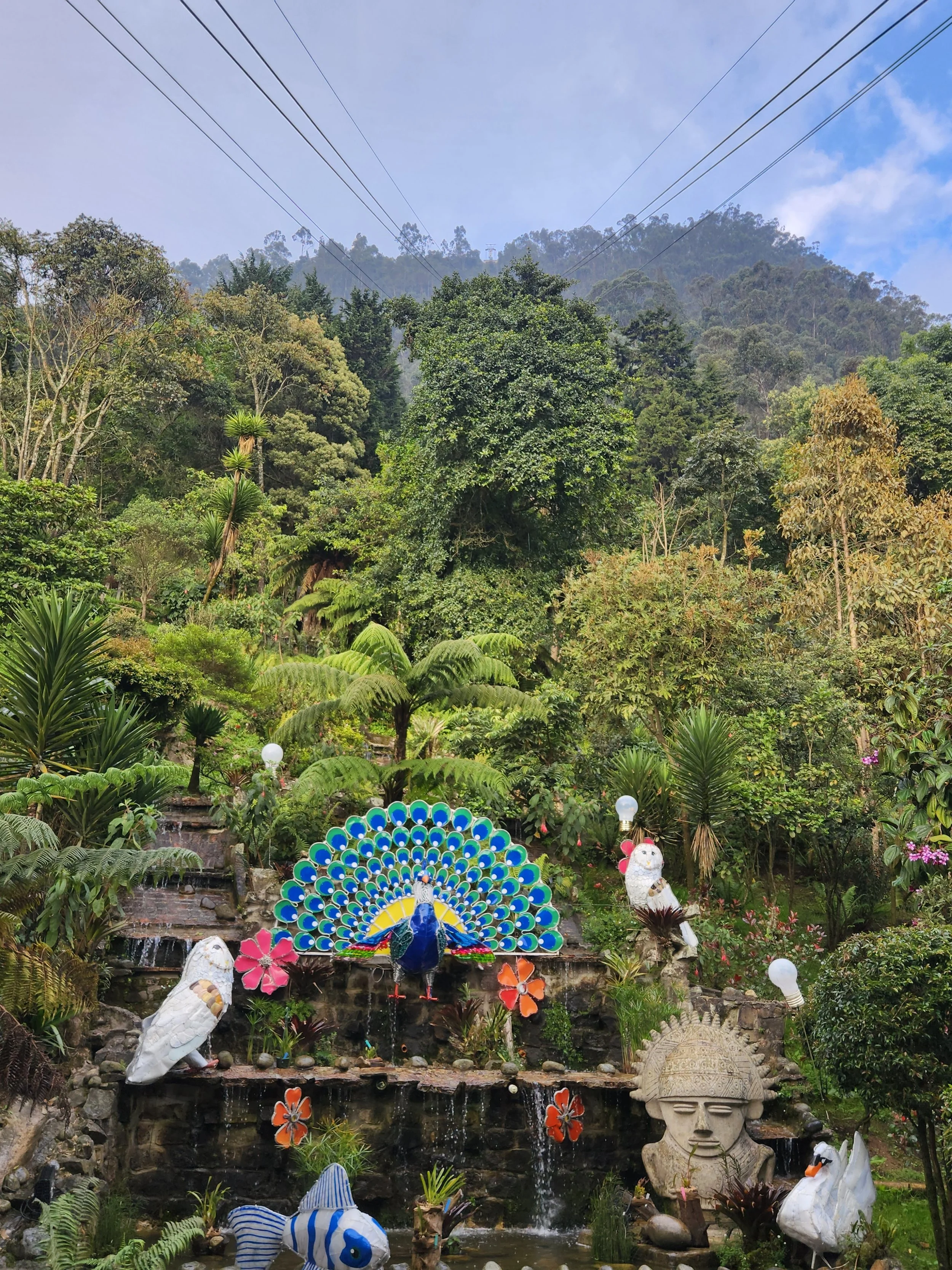
More on our way to Salento

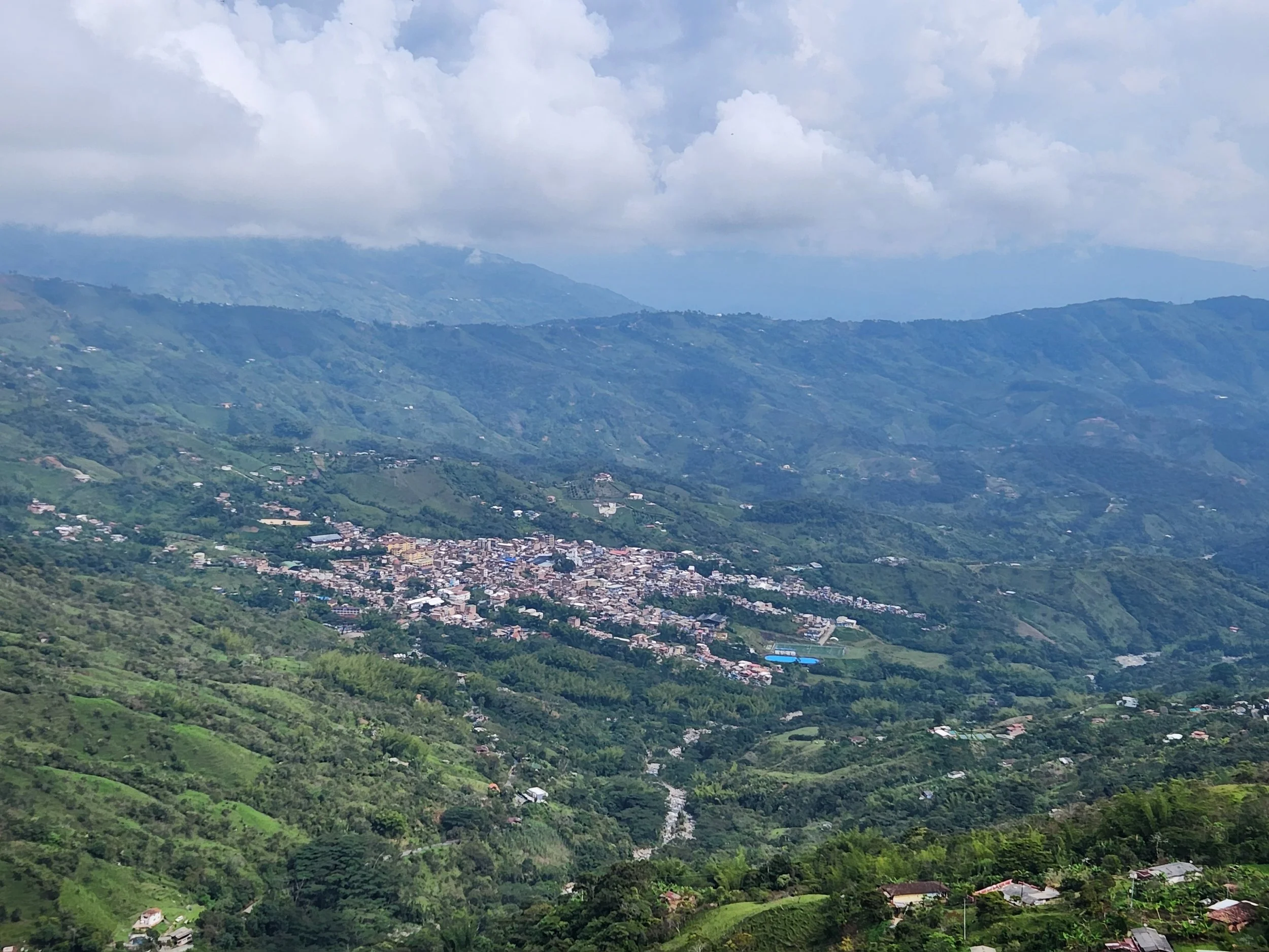
This is the overlook we stopped at for the pictures of both the waterfall and the town in the valley below. (prior two pictures)
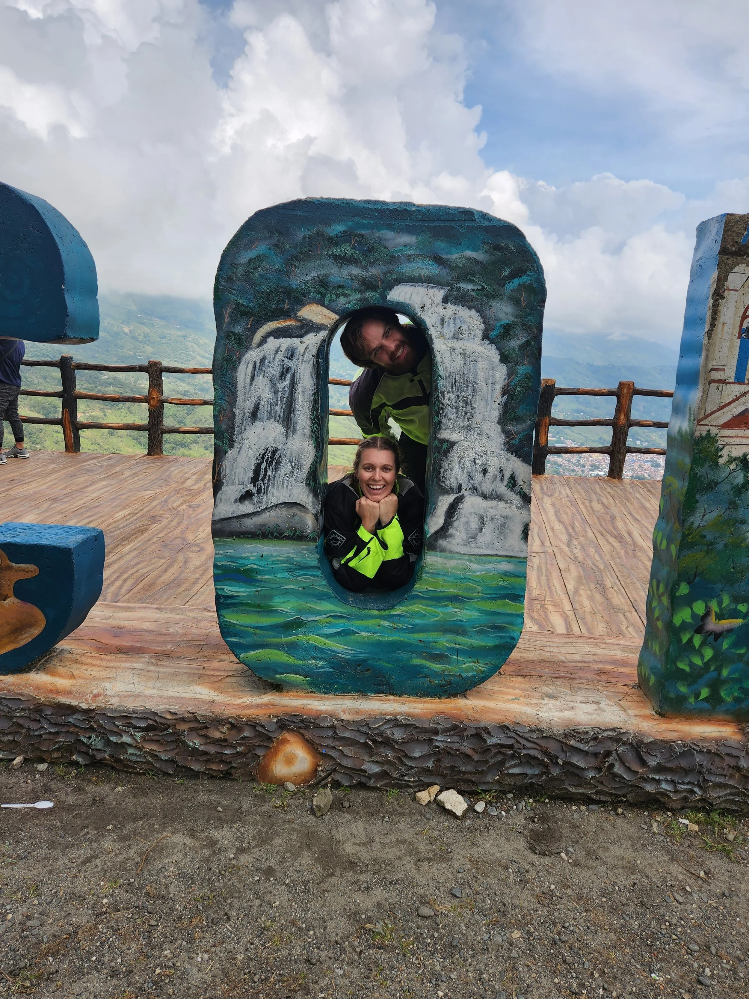
Hamming it up!

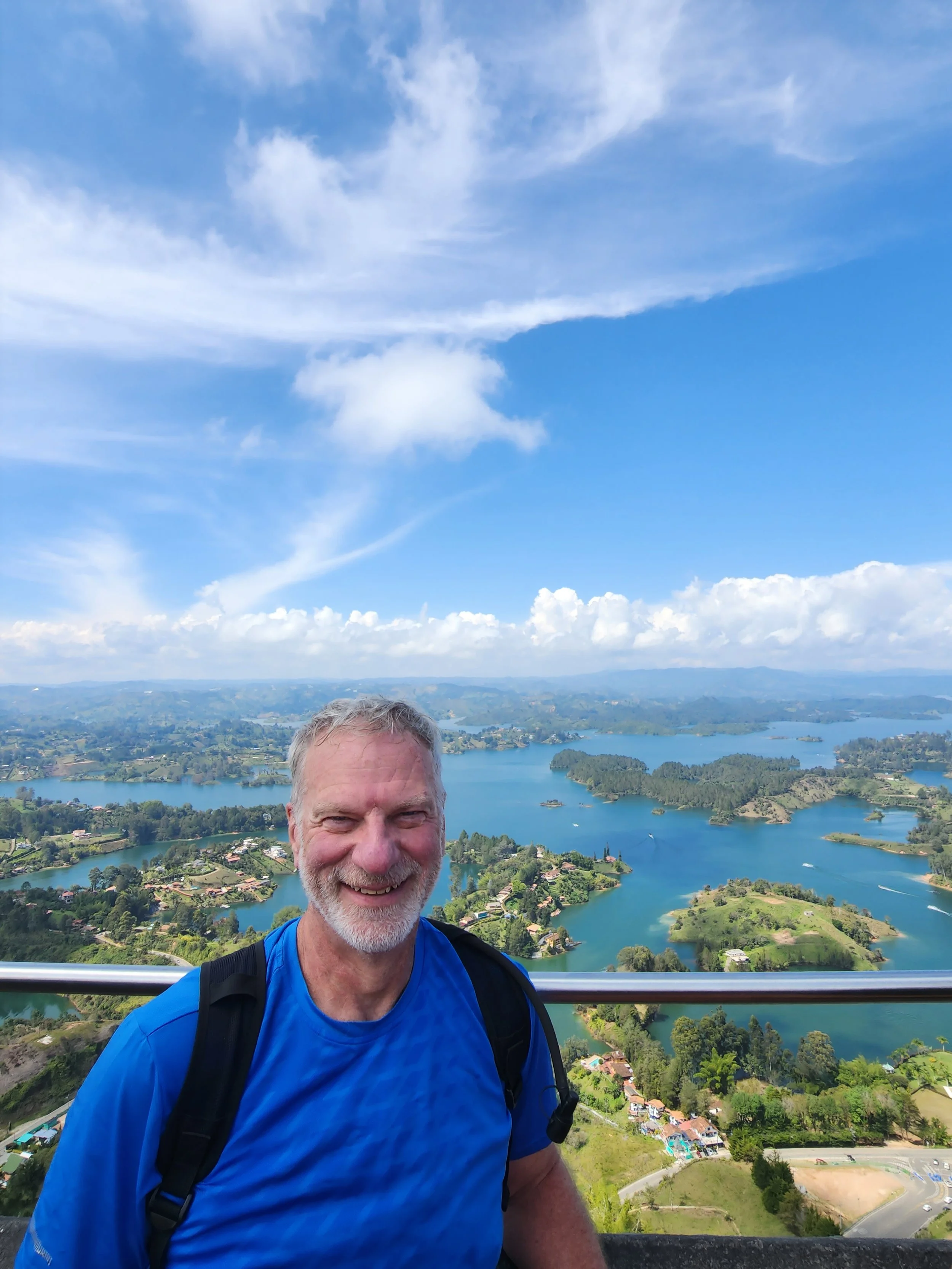
The view of the lake at Guatape from our hotel.

A very civilized Christmas Eve at Guatape

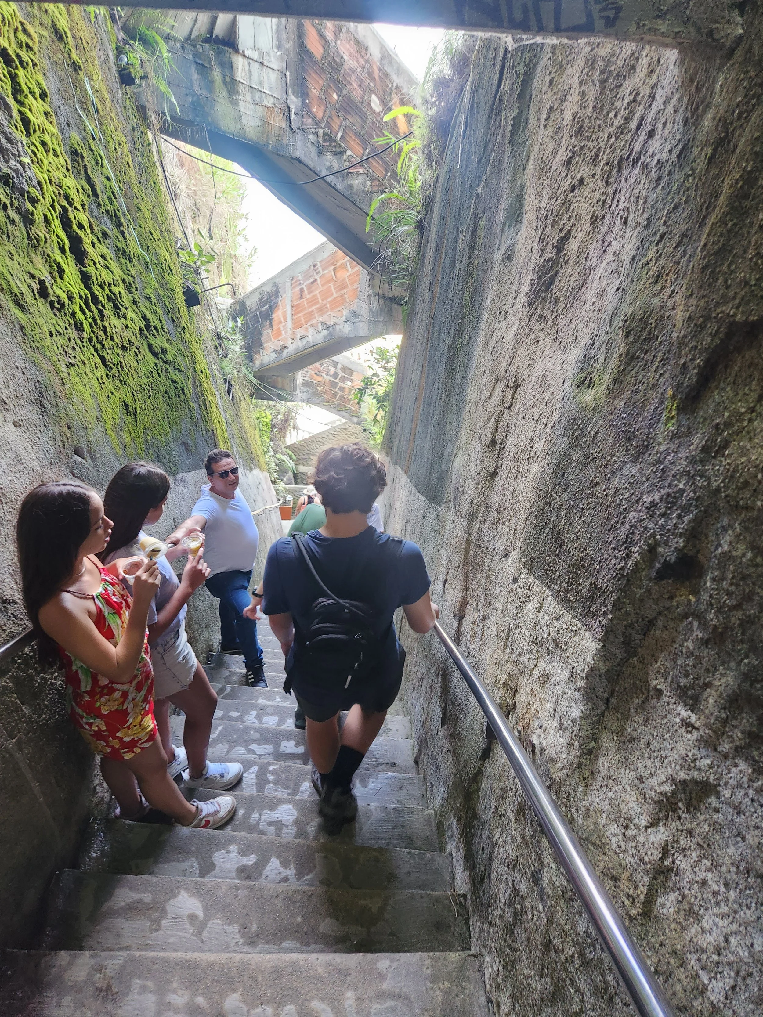
Christmas day found us climbing "The Rock" There are actually two sets of stairs here. The outer set that is visible here is for going up. The original stairs sit in the crevice behind these and are used for going back down. There is a place to stop for a rest and buy some drinks half way up as well.

A closer shot of the stairs.


And the view from the top of the lake


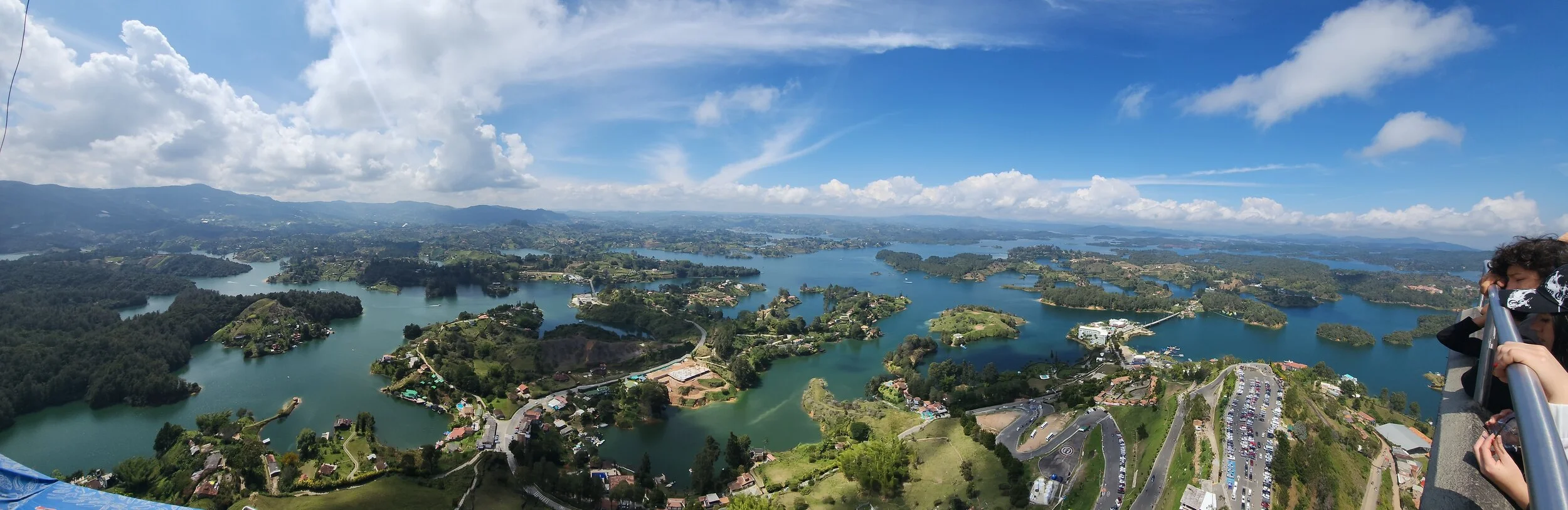
Guatape panorama from the top of the rock

Once you are on the top of the rock you still need to climb 2 more stories to the top of the mirador to reach the highest point.
The descent

Heading back to where we started.

There are actually two towns on the lake. Guatape and Pinon. The rock is closer to Guatape and they tried to "claim" it by painting the letter G on it. Originally there was going to be the whole name, but Pinon sued before they could finish and won a verdict to stop the painting. What looks like a 1 was just the first part of a capital U that was being painted with they were ordered to stop.
Coffee country from the coffee farm we did a tour of.


Salento has brightly colored houses and businesses all though. This was just one residential street I found while walking around.

The two attractions at Salento are the coffee farms and Corcora National Park. There are no traditional taxis in town. Getting to and from the sights if you don't have your own care are with one of the fleet of these Willys Jeeps

Neil and I riding the bumper of our jeep going out to the coffee farm

We even got to pick some coffee beans. IT was between harvests so the pickings were slim. We were told that the local pickers could make as much as the equivalent of US $18 per day during harvests picking the beans.
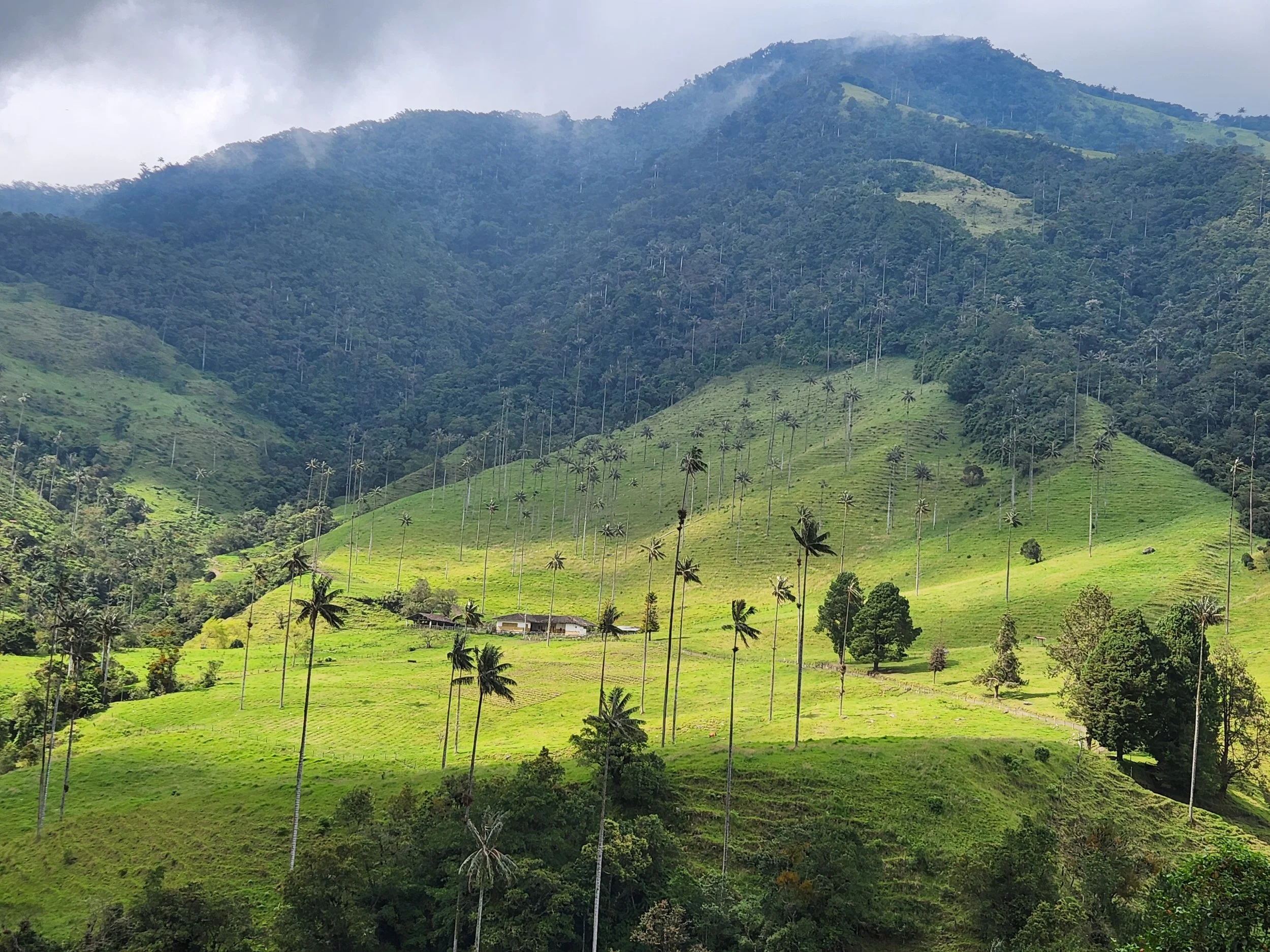
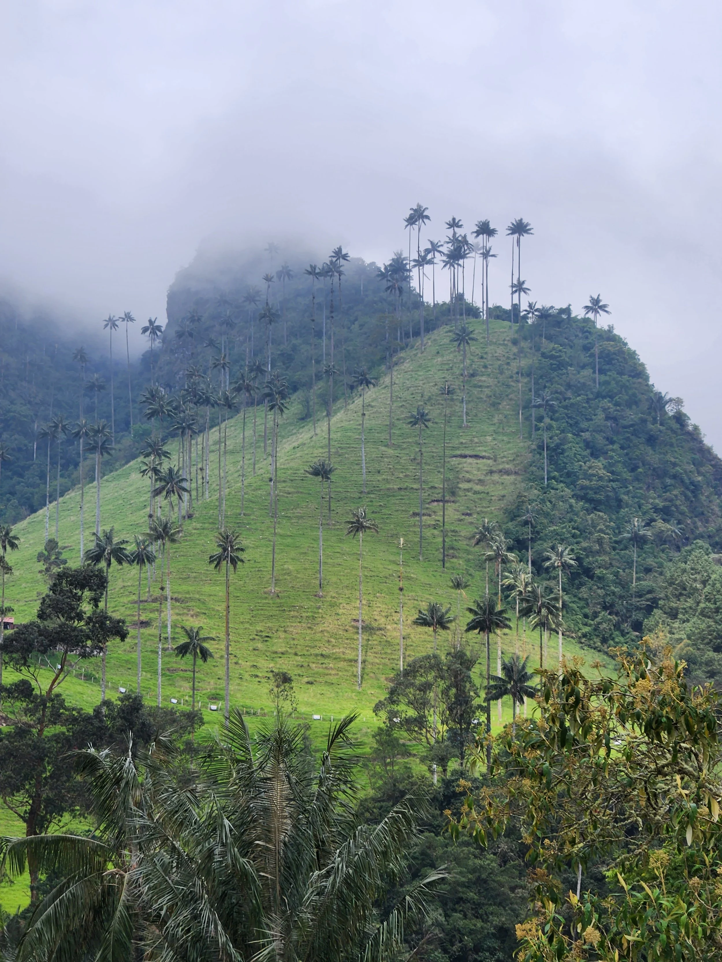
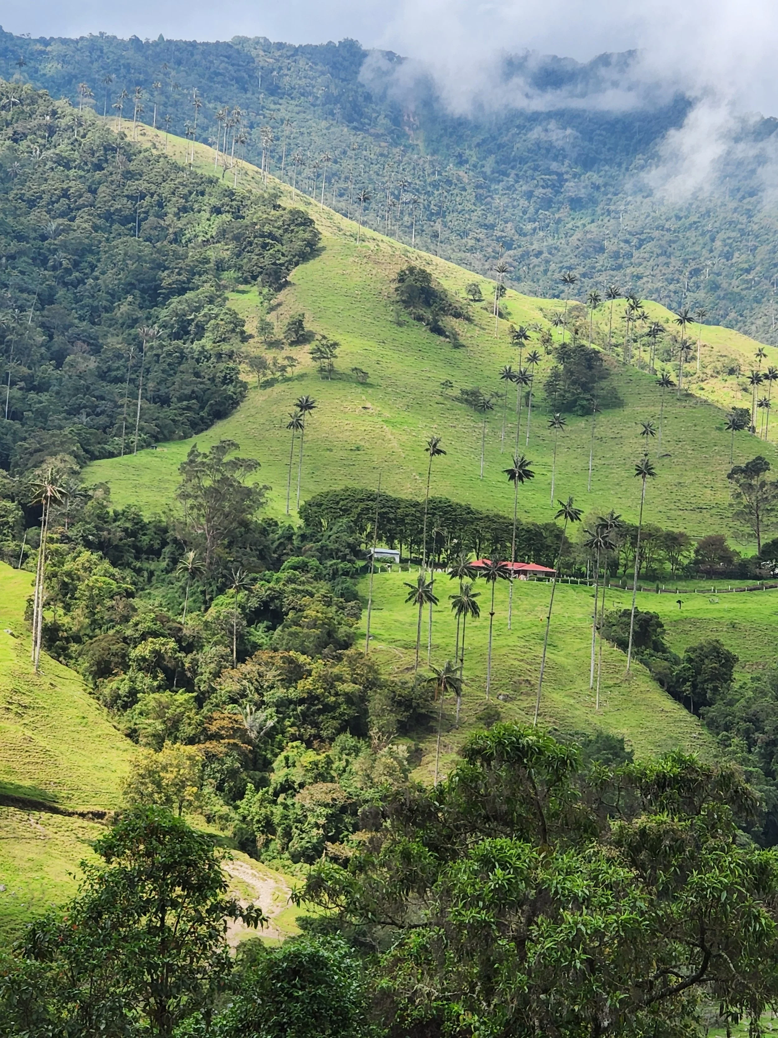
Corcora Park and the world's tallest palm trees


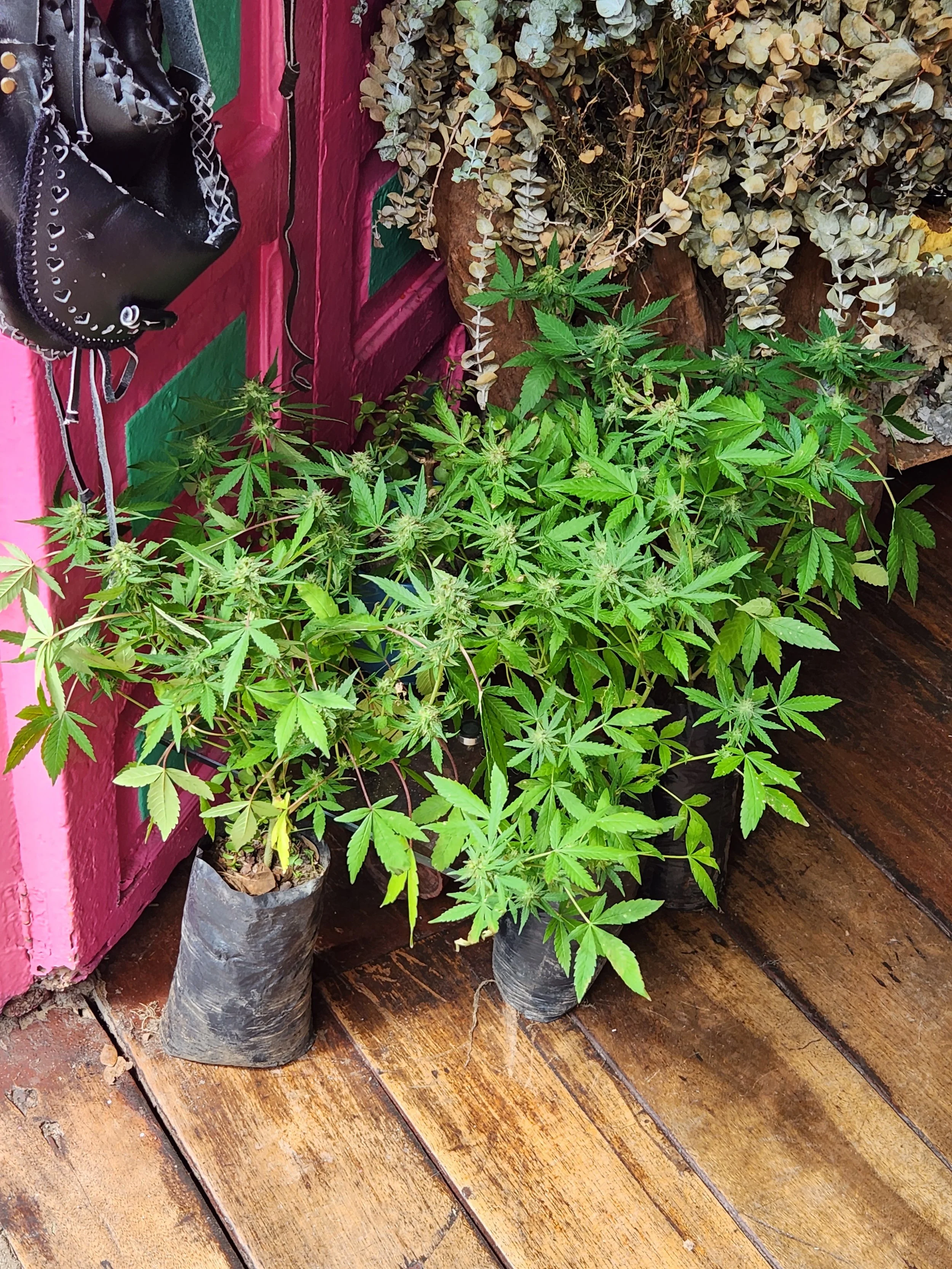
If you need marijuana plant starters just come to one of many shops in Salento where they are just setting out ready for purchase.
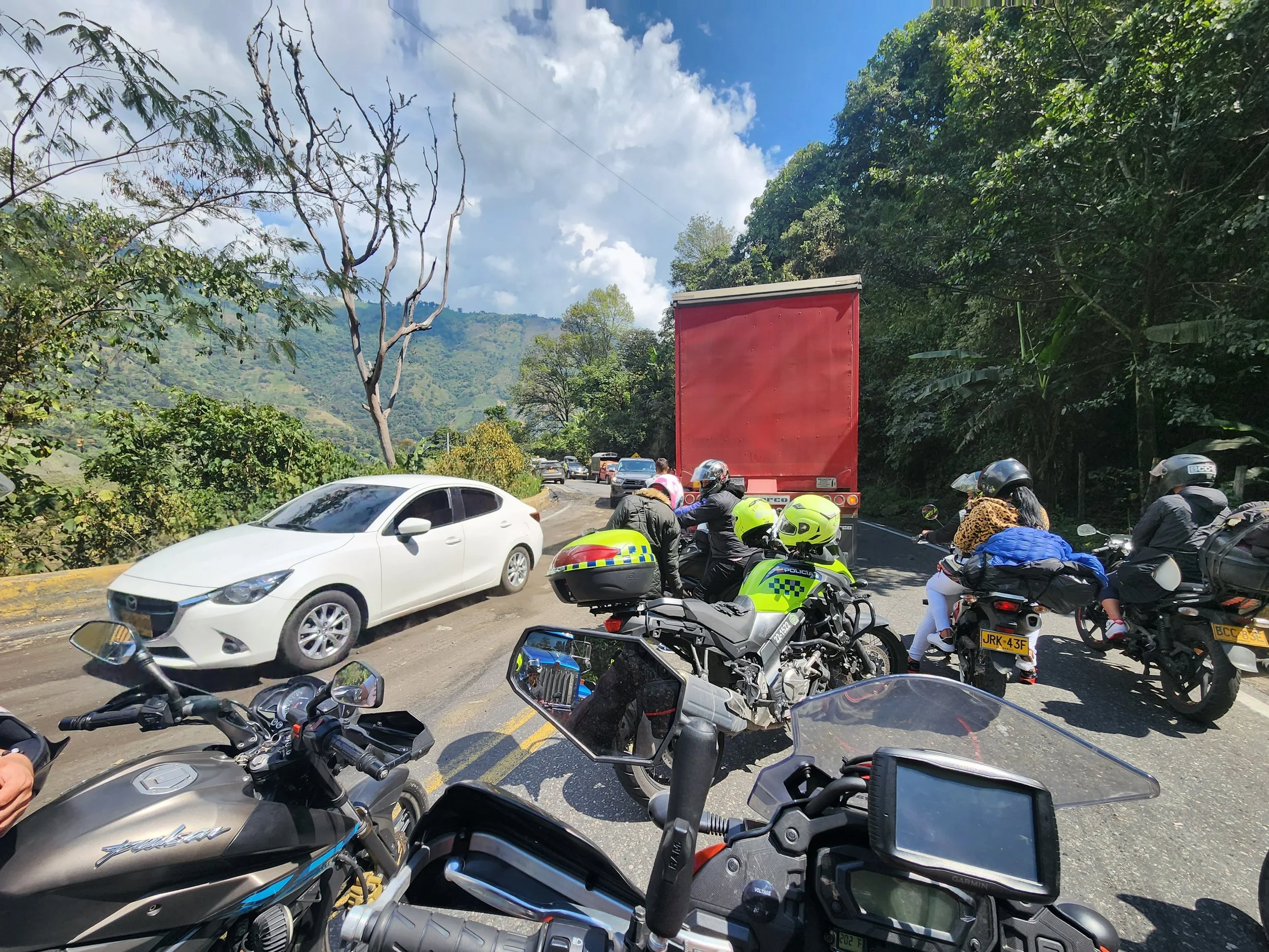
The traffic snarl at the accident on our way to Melgar on the next to last riding day of the trip.


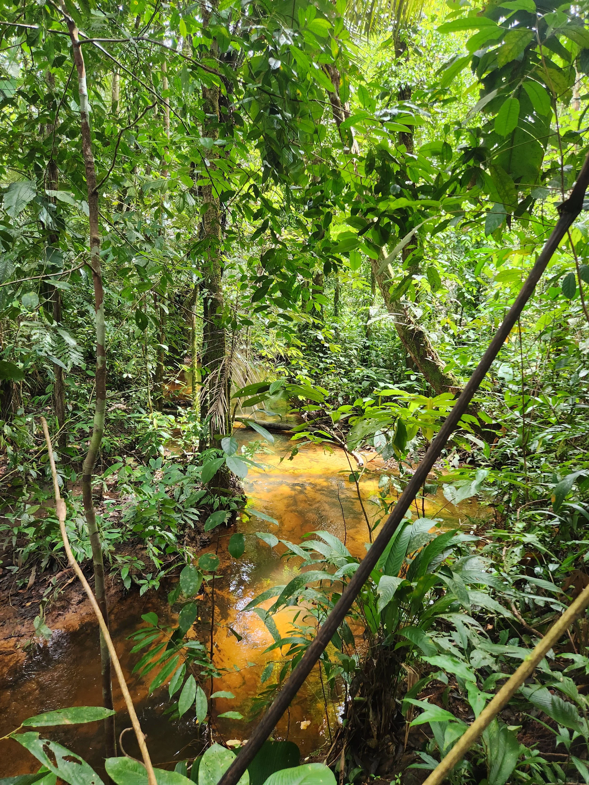
Paxson on our hike through the Amazon rain forrest.

Termite colony on at tree trunk.
We could hear planes taking off and landing at Leticia but sure seemed like we were miles from nowhere.

Our hotel in Leticia had a family of ducks that would wander around the open air lobby.

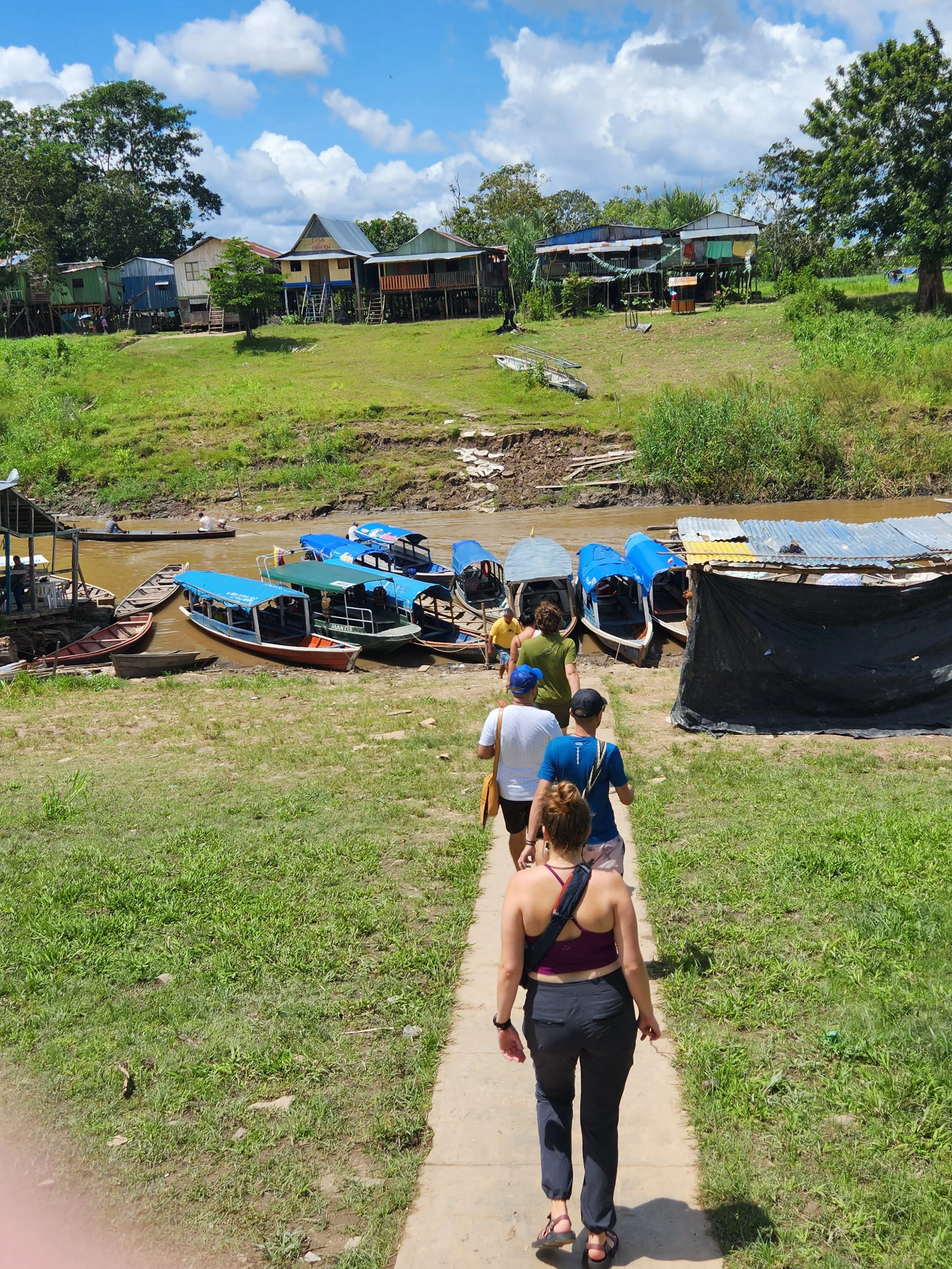
Walking down to our boat to start the ride up the Amazon River to Monkey Island.

These boats are only used to ferry people from the small channels out to the boats on the main river.
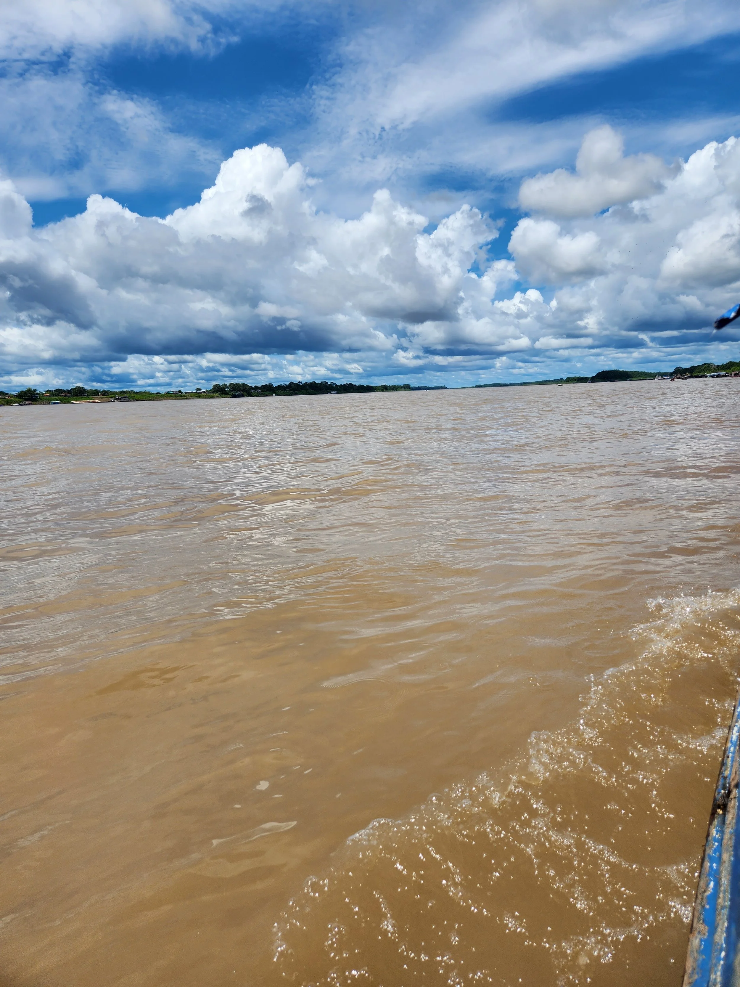
The main channel of the Amazon at Leticia. At this point we are approximately 3,000 miles from the mouth of the river and it's still this wide!


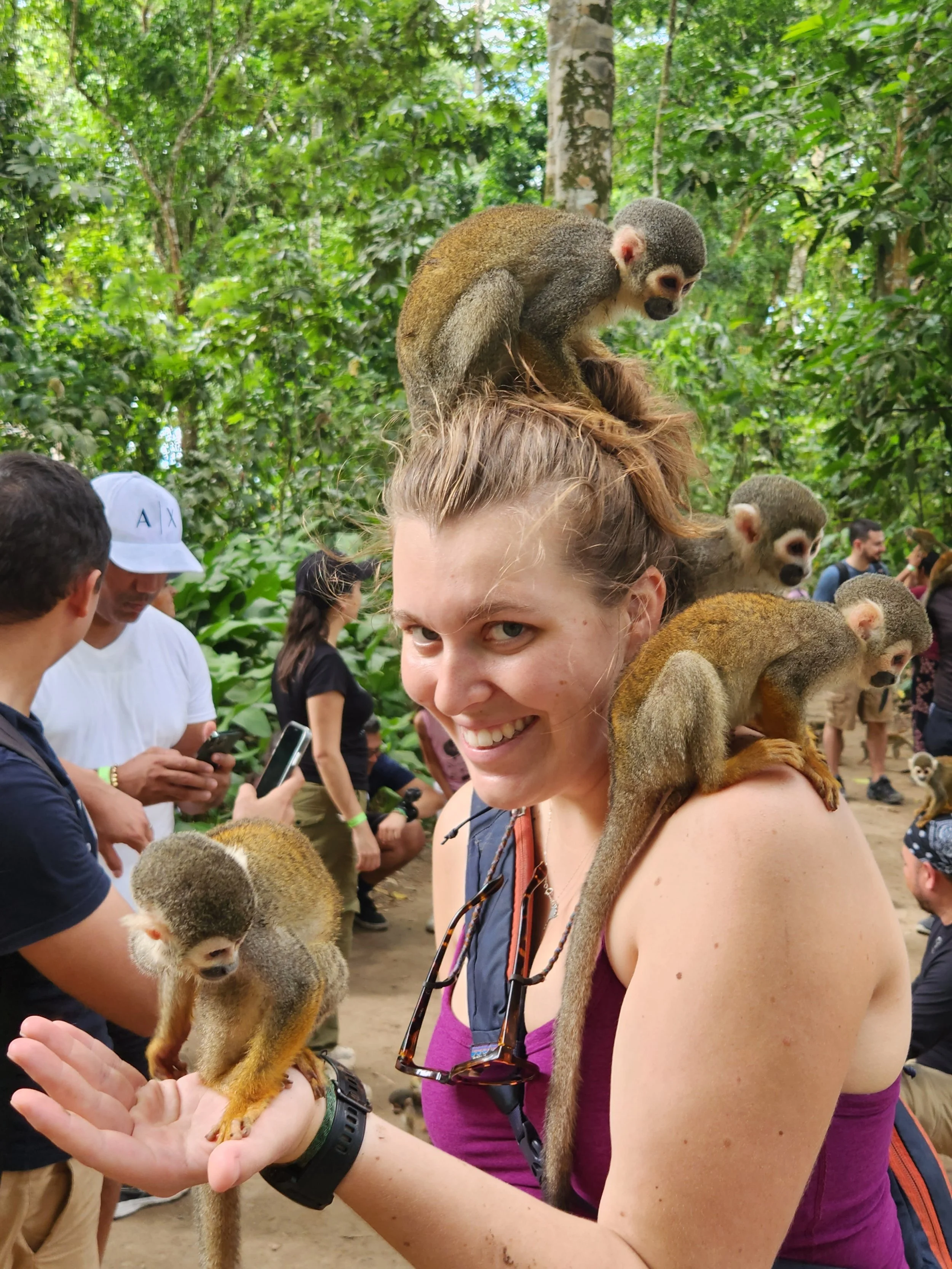
The entrance to Monkey Island


Leticia boat launch area

This is the foot bridge across the channel we took the long boat out of. We decided to walk across the island and bridge to get back to town rather than take the boat around on our return.


The tunnel into the Salt Cathedral

The entrance to the cathedral is a path representing the "Way of the Cross". It has 14 alcoves representing the events in the Passion of Christ.

The cathedral holds public mass on Sundays